Antoine Peak’s Emerald Necklace is a fantastic way to experience all of the sights of this large conservation area just north of the Spokane Valley. Starting from the west trailhead minimizes the elevation gain, although the Emerald Necklace can be reached from the east trailhead as well.
Begin by ascending the new singletrack trail on the open grassy hillside just above the parking lot. Hikers will need to cross the cell tower access road, an alternate hiking option that stays in the trees and meets the singletrack again at the top of the first hill. It’s a little under a mile to the intersection with the Emerald Necklace route, and on a clear day the views of the Spokane Valley are superb.
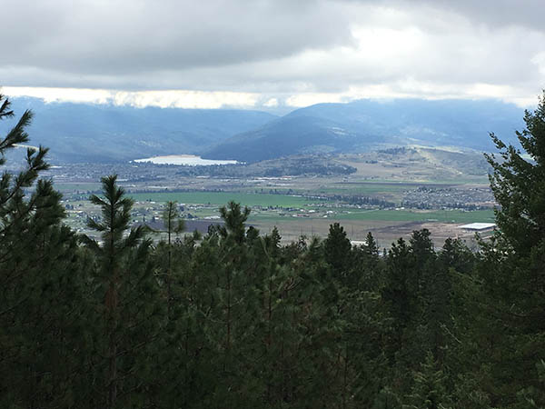
Young hikers will enjoy spying on valley trains from afar, yet within earshot of the piercing train whistle. Arbor Crest Winery is visible from its perch atop a cliff overlooking the ribbon of the Spokane River to the southwest. It’s also easy to spot neighboring conservation areas at the south end of the Spokane Valley, with the towers of Iller Creek/Rocks of Sharon to the southwest and the dome of Mica Peak visible to the southeast.
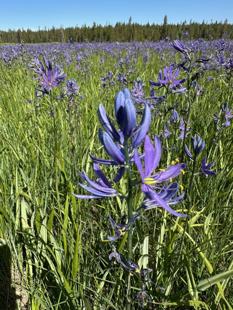
At the top of the first hill, rejoin the tower access road for a short section to a signed trail junction for the Emerald Necklace. For the easiest hike, turn right at this junction, noting the return route on the left. This section of the hike is along an old roadbed with views of the Spokane Valley and Liberty Lake. While an excellent hike in all seasons, May is an especially nice time to visit due to generally good visibility and peak wildflower blooms within the conservation area.
At approximately the 3-mile mark, hikers will reach the “chicken-foot intersection.” Remain on the Emerald Necklace by proceeding straight ahead, but note the trail on the left leads to the summit of Antoine Peak, whereas the trail on the right leads to the east trailhead.
The north side of the Emerald Necklace is an entirely different ecosystem. Note the lush growth and greater variety of tree and bush species on this wetter side of the mountain. There are fewer views into the distance, but Mount Spokane State Park is prominent from several vantage points along the way.
At approximately the 4.3-mile mark the trail intersects the west side summit trail, an optional extension of this hike for those who would enjoy the view from the top. For the main hike, continue straight ahead and downhill. At about the 4.7 mile mark, hikers will return to the first Emerald Necklace sign. Stay straight and return via the same route you ascended to start the hike. This hike is especially pleasant around sunset, as the hike out faces west for best viewing of evening light over Spokane.
Round-trip distance: 5.7 miles
Rating: Moderate
Elevation gain: 780 feet
Getting there: From the Spokane Valley, travel north on Forker Road to the new Bigelow/Forker interchange. Continue north on Forker and take the first right (east) on Brevier Road. Pass the intersection with Adams Road and continue east on Brevier to the signed Antoine Peak Conservation Area parking lot. Passenger vehicles should use the paved parking spaces at the east end of the lot, saving room for horse trailers along the south side and in the middle.
Support Local Trails: Volunteer with the Washington Trails Association (WTA) for a fun and rewarding way to give back to the places you love to hike. Trails across Washington need our help more than ever. The next WTA work party will be at Fishtrap west of Spokane on May 4 and Antoine Peak on May 15. See www.wta.org/volunteer for more information. //
Holly Weiler is easing back into trail running after a long winter hiatus that included plenty of time spent on skis instead. She writes the Hike of the Month column every month for Out There.