By Chic Burge
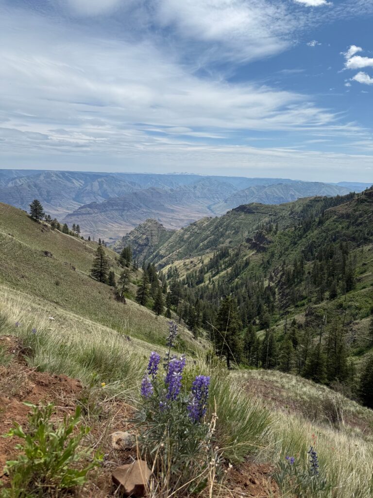
We all have heard about the beautiful fall colors on the right coast, but I contend that we have some beautiful fall colors in our own backyard. The nice thing about the Inland Northwest’s fall colors is that you don’t have to fly back east, deal with airports and crowds or spend a small fortune.
For the past 50 years, I’ve hiked, skied and photographed most all of our region’s beautiful high country in all seasons. Although I’ve never traveled back east, I do believe that we should be very proud of our fall colors, which are best viewed from mid-September to mid-October. (However, each area and its micro climate may cause the fall color timeline to vary).
My favorite fall color hiking is in the Stevens Peak area along the Idaho/Montana border, two and a half miles south of Mullan, Idaho – specifically Upper and Lower Stevens Lakes, St. Regis Lakes, and Lone Lake. Each lake provides its own flavor and beauty and unique approach.
Upper & Lower Stevens Lakes
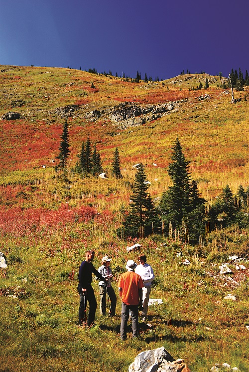
Upper Stevens Lake in early October is my choice for the best fall colors in our area. The reds, yellows and oranges are brilliant above the deep blue of the high country lake and the gray of the granite scattered along the hillside.
There are three waterfront campsites at the lower lake and two at the upper lake. At both Stevens Lakes, walk east across their exit creeks for great reflection photos. A good alternative hike here is to climb up to the west ridge above the upper lake to the top of the ridge and drop into the Lone Lake drainage and out to the same trailhead. This can be done from Lone Lake’s “Upper Sanctuary” to Stevens Lakes as well.
Yes, it’s strenuous, but it offers views that most don’t see and is a good route to the summit of Stevens Peak. The hike to the lower lake is five miles roundtrip, with another .5 miles each way to reach the upper lake.
Lone Lake & the “Upper Sanctuary”
Just west one drainage from the Stevens Lakes, and from the same trailhead parking area, is the hike into Lone Lake. This 4.5 mile roundtrip hike is moderately difficult and affords hikers views of the 400 feet of vertical cascades.
Above the lower basin along the trail is another nice side creek that cascades near the trail. Once at the lake, take a swim if it’s warm enough and enjoy the views. Make sure to walk around to the right side of the lake to a small waterfall.
Just above the falls is an area that I call the “Upper Sanctuary.” There is no real trail, but it’s a short hike that offers peace and quiet. Once in the sanctuary, the views of the dramatic north face of Stevens Peak loom high above. Walk past the small upper pond to one of the two prominent knobs, and while having lunch, enjoy the serenity. You may think you’re in a foreign country.
This hike is also spectacular in late May and early June.
Getting to Stevens and Lone Lakes:
To get to the trailhead for both lakes, drive east on I-90 from Spokane, and take exit 69 near Mullan. Turn left and cross over the freeway. At the stop sign, turn right and drive past the Lucky Friday mine to a “Y” in the road. Bear right and stay on this road until it crosses back over the freeway. The road turns to gravel and is about a mile to the trailhead.
The trail to Stevens Lakes is near the parking area to the south, while the Lone Lake trail is on the west side of Willow Creek a short distance away (look for a huge boulder next to the road). To reach Lone Lake, you can drive up a mile or so, but the beginning of this road is rough. The trail starts on a decommissioned road so watch for the path that bears right, heading due south uphill. Don’t take side roads.
St. Regis Lakes
From Lookout Pass Ski and Recreation Area, the 6 mile roundtrip hike to the St. Regis Lakes offers a nice, relatively easy backcountry hike into two small lakes just east of Stevens Peak. The first part of the hike is on a rough road heading up the drainage before transitioning to actual trail for the final half or so of the hike. On the way up the headwall, look back across the valley to the north. This ridge provides great fall colors with splashes of Idaho granite to accent the view. The final half mile of the hike is a bit strenuous, and the upper lake is a short scramble from the main lake.
For a longer and harder hike, you can jump up on the back ridge and access Stevens Peak, which straddles the Idaho/Montana border. At one point along the ridge, you can see both Stevens Lakes and Lone Lake, separated by a north-south ridge, all in the same view.
Getting There:
Take Lookout Pass Exit 0 east of Wallace, turn right at the exit stop, and then turn left at the junction, heading away from the ski area and downhill. Drive a little under a mile and turn right on a gravel road and continue a short ways to the trailhead.
Crystal Lake
Another hike worth the effort is Crystal Lake on the lesser known Rochat Divide, not far east of 4th of July Pass and Coeur d’Alene. This lake is located on the south end of the divide, between Cataldo and St. Maries.
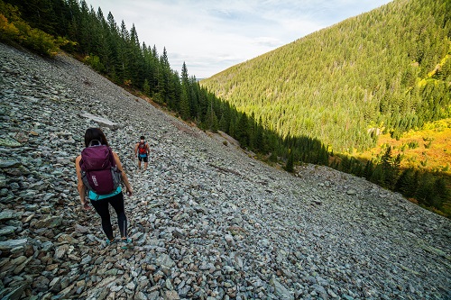
The hike starts at the Bureau of Land Management Sheep Springs camping area where the trail drops down to the south of the parking area and heads south out to the lake. The trail traverses a lot of rock scree, but it is relatively simple to hike. The lake is 1.5 miles from the trailhead, and the trail drops about 200-300 feet on its journey.
About two-thirds of the way to the lake, the trail crosses a small stream and then winds along out to the lake. There’s also a poor trail around the lake to the east side. On the south side of the lake is a peninsula that protrudes out into the water. Some of my best photos of Crystal Lake are from here.
An alternative hike to the lake starts at a trailhead one mile south of Sheep Springs just as the road drops off the south side of the divide. This trail is a bit steeper but shorter.
However, a third (and my preferred route) starts at the Sheep Springs trailhead and heads south and cross-country up the steep ridge on the right which overlooks the whole area. This high ridge offers views of the vast Idaho Panhandle National Forest, Lake Coeur d’Alene and the shadowy St. Joe River areas. The ridge top is mostly barren, which affords great views of fall colors and mountains all around.
Once you’ve hiked to the south end of the ridge, pick up the trail from the south end. Turn left on this trail and head down to the lake. Just as you have turned left, you will notice that all the old trees are curved from their base from land surges. This area has produced some of my favorite trail photos. Once at the lake, the trail back to your car is to the north. Along the trail out, you will round vertical ridges; make sure to check out the fall colors contrasting with evergreens and sedimentary rock scree off in the distance along the trail.
Getting There:
To get to the Rochat Divide, head east from Coeur d’Alene on I-90 to Cataldo. At the exit stop, turn left (south) and head up the Latour Creek drainage, which parallels the freeway to the west for a few miles before heading south up into the hills. Stay on this main road for about 17 miles to the trailhead. The trailhead is not signed but has an outhouse on the right. This area has been logged, so pay attention and stay on the main dirt road.
While in the area, there is a good side trip up to St. Joe Baldy to the southwest of the southern trailhead. There’s a cool campground on the south side of St Joe Baldy that overlooks the St. Maries and the St. Joe River valleys. This area can be accessed via the St Joe River from the south as well. Look for the St. Joe Baldy road signs.
Navigation Note:
We recommend carrying a map and compass and/or GPS device that you know how to use on all of these and other backcountry hikes. Rich Landers “100 Hikes in the Inland Northwest,” the trail hiking bible for our region, is also an indispensable navigation resource.
Fall Colors Closer to Spokane
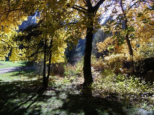
For those who want to experience our region’s fall colors without traveling far from the City of Spokane, don’t miss the Finch Arboretum. My favorite time to visit the arboretum is in very late October to mid-November. I call and find out when they are going to rake and vacuum up the downed leaves and go just before that date.
Many inches of fall colored leaves are on the ground and offer great ground cover photos along Garden Springs Creek as it descends through the 65-acre park. Learn more: wta.org/go-hiking/hikes/finch-arboretum
Chic Burge‘s uncle taught him how to downhill ski when he was five and XC ski when he was 9, and he’s been addicted to the outdoors ever since (his uncle also gave him his first camera on that XC ski trip). He started climbing in the 60s, and in 1984 he joined the Spokane Mountaineers to learn new climbing techniques (he is currently the club’s Historian). Chic lives to ski, but also fills his time biking, kayaking, taking beautiful photos and hiking between ski seasons. In 2020, Chic created the Inland NW Routes catalog website of hiking routes and trails with David Crafton.
Originally published as “Silver And Gold: Fall Hikes In Idaho’s Silver Valley” in the October 2014 print issue.