There are a few outdoor adventures in the Inland Northwest that are available only a couple of times each year. Skiing two feet of fresh powder at a local ski area is one of those, and another is the opportunity to take a whitewater run down Latah Creek. Of course, when Latah does run, “whitewater” is a euphemism since the flow will be the color and consistency of a Starbuck’s mocha. However, unlike the mocha, you will not want any of this in your mouth, given the amount of fertilizer, livestock excrement and other nasties that run off the Palouse farmland into the creek.
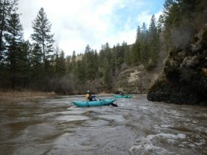
That being said, the experience is well worth the diligence and schedule flexibility it takes to make the run. The creek actually begins in Benewah county, Idaho, and runs north through the Palouse, eventually joining the Spokane River at People’s Park. True to its name, for most of the year it is, indeed, just a meandering creek that you could walk across with hip waders. However, when two environmental events occur together, it becomes a full-blown river with flows that can equal, or exceed, that of the Spokane River itself. What is needed is a snow pack of 8 inches or more, combined with a sudden warming trend and rain.
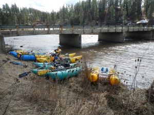
Just such a combination occurred the first week of March, and several members of the Northwest Whitewater Association took advantage of the opportunity. In order to have enough flow to make the trip worthwhile, you need at least 1,500 cfs on the Spokane gauge. This information is available at: waterdata.usgs.gov/wa/nwis/uv/?site_no=12424000&PARAmeter_cd=00060,00065.
The reason you need diligence and flexibility is that the creek peaks and recedes at an alarming rate. On March 4th (Tuesday), the reading was about 150 cfs, and by Saturday it was back down to 1000 cfs. Our group missed the peak flow on Thursday (7500 cfs), but had a very nice run on Friday at about 2000 cfs. In previous years, members of the club have run the creek with flows as high as 20,000 cfs.
While it would seem that floating a creek through farmland wouldn’t be much fun, the creek actually enters a wilderness gorge just downstream of our usual put-in, at the bridge where North Kentuch Trails Road crosses the creek east of Spangle. The flow is consistent, with mostly Class II-III action until you reach calmer water about a mile above where Rock Creek enters from the east. There are two rapids of note, one just upriver of the Keevy Road bridge, and another about a half mile downstream that has gotten the name “Little Cliffside.”
There used to be a nice take-out on private land above Rock Creek, but some impolite boaters left trash and caused some damage, so the owner has closed off that access. The easiest place to get off the creek is across from where Elder Road connects with Valley Chapel Road. While that increases the amount of “flat” water, there is an exciting surf wave just downstream of where Spangle Creek comes in.
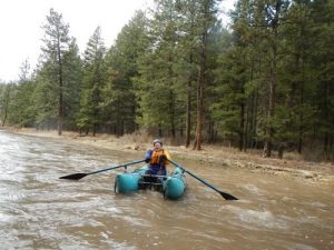
Our club has evolved into a mostly cataraft group, and this would be my recommendation for Latah. It keeps you out of the “toxic soup,” as opposed to a kayak or IK, and allows you to surf the numerous waves and holes that develop along the way. A drysuit is mandatory, given the cold water, and the fact that you are often running it in the rain, though we were lucky to have intermittent sunshine.
The creek has peaked three times this year, and there may be one more opportunity, but you better be prepared to call in sick and have your gear available or you will miss it. All too often the comment you hear about Latah is “you should have been here yesterday.”
Written by Dan Schaffer


