SIX DECADES SEARCHING FOR THE SECRETS OF STEVENS PEAK
By Chic Burge
Cover photo courtesy of the Nellie Stockbridge from the Barnard-Stockbridge Studio
Editor’s Introduction—Longtime North Idaho resident Chic Burge has spent nearly 60 years exploring the Stevens Peak area near Lookout Pass, just south of I-90 along the Idaho/Montana border. His ongoing research and years on the ground hiking and searching for clues have focused on the history, trails, peaks and lakes of this mountainous “Alpine Lakes Region.” In a series of three stories illustrated with dozens of his own scenic photos and historical images he compiled through his research, Burge has assembled an impressive collection of mining and outdoor recreation history of this region on his Inland NW Routes website. This version has been adapted for print, so to see the complete project and many more photos, scan the QR code at the end of the article to visit his website.
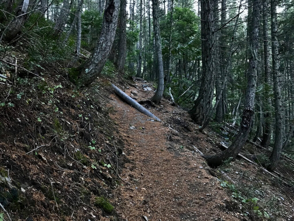
If you have hiked Trail #165 up to Stevens Lakes, you likely stepped over one of the area’s most overlooked historic artifacts that piqued Chic’s interest in its origin and inspired years of research. This century-old water pipeline was built to serve the Reindeer Queen Mine, which was incorporated in 1913. Miners drove tunnels into the mountainside in search of copper, silver, lead and zinc. Although the mine never was a big producer, it was an ambitious operation that left mining remnants scattered around the Stevens Peak and Stevens Lakes area. (OTO)
THE STORY OF THE PIPELINE ON THE EAST WILLOW CREEK TRAIL #165
Have you ever wondered about the pipeline along the Stevens Lakes Trail? I first hiked into the Stevens Lakes area in the mid-1960s. Back then, there were few trees, mostly young subalpine fir. The whole area was ravaged by wildfires in 1893 and 1894, the Great Fire of 1910 and again in 1928.
Since then, I have always wondered what the pipe was used for, but more importantly how they got the 24-foot-long by 10-inch-diameter pipe sections in place up Trail #165. If you’ve hiked it, you know what I mean. Keep in mind the current long switchback on the scree slope wasn’t the trail back then. The old trail stayed close to the west side of East Fork Willow Creek.
The pipe was placed in a trench deep enough that if an avalanche occurred, it could not be dislodged. Over 100 years of sediment, pine needles, leaves and other forest debris have fallen, nearly covering the pipe in its ditch. The miners built a 5-foot-tall log dam stretching across the exit creek below the headwall to form a reservoir and water source.
Because the miners constructed a trench to hold the pipe, I believe they used horses to transport the pipe to the upper sections via that trench. The pack train couldn’t turn the many sharp corners coming up the current Trail #165, so that’s likely the only way they could have hauled the long sections up the mountain.
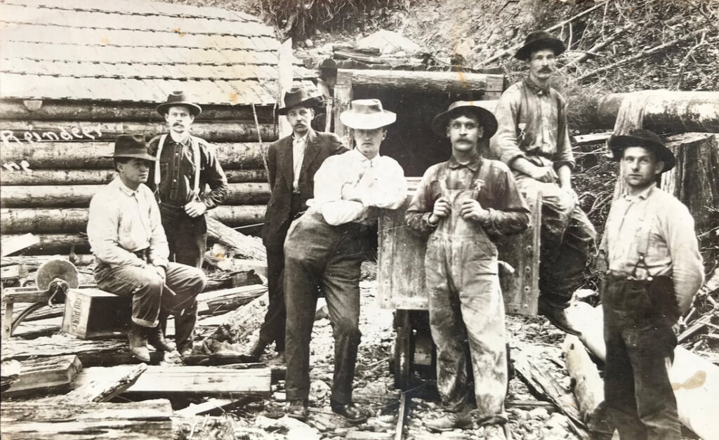
The miners used the water pressure to wash their equipment, keep the dust down inside the mine, suppress fires, supply water for human use, generate electricity and power their new water-powered Ingersoll-Rand air compressor. So the next time you hike into Stevens Lakes, think of the efforts put forth by those miners working the area from the late 1800s to 1933 and beyond.
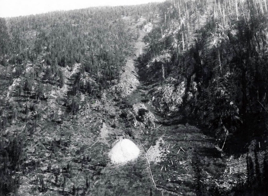
THE UPPER PIPELINE FROM LOWER STEVENS LAKE
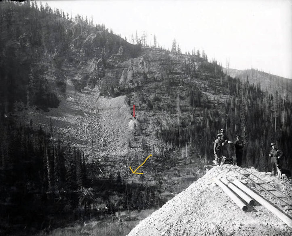
In the process of doing research at the Captain John Mullan Museum, I came across references to a second pipeline in the Stevens Lakes area. I spent hours examining the photos of Wallace resident and frontier mining photographer Nellie Stockbridge, and found one that got me interested in the original pipeline’s history. I first thought the two pipes were used together but learned that they were used at different mines and were from different reservoirs. The miners had installed an upper 800-foot section of pipe all the way up to Lower Stevens Lake.
The upper pipe in this image is vastly different from the 10-inch pipe lower down the drainage—it’s also a 10-inch-diameter pipe but weighs a lot less, making it easier to get all the way up East Fork Willow Creek to Lower Stevens Lake, where it was placed in the lake to act like a siphon.
Because Trail #165 is so rough, steep and twisted, the miners couldn’t have brought these pipe sections up the hiking trail. So one day, I walked up to the Silver Crest Mine and searched for clues. Above the dump site in the image, I noticed the whitish pipeline that goes left from the waste dump. I walked out past the Carney 1-3 mine site. The old trail in the photo fades into the earth past these mines, so there is a possibility that the water pipe terminated at the Carney 1-3 mines.
In either 1916 or 1917, the dam at Lower Stevens Lake that formed the reservoir used as the upper pipeline water source failed. The rush of water created a 30-foot-tall wall of water all the way down the East Fork Willow Creek drainage. It destroyed all the Reindeer Queen Mine buildings and other structures along its path.
Near the present trailhead, there was a train trestle that crossed over Willow Creek, just west of the parking area. It was made of timbers and was washed away in the flood. After the washout, the Northern Pacific Railway created an earthen railroad crossing above all the creeks. This crossing leads to the Lone Lake Trail #138 on the west side of Willow Creek.
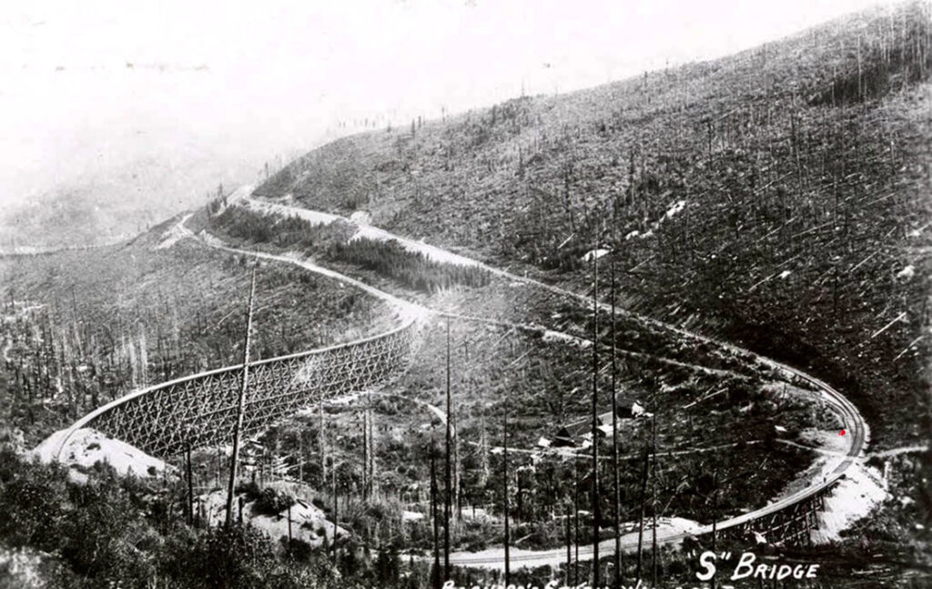
The flood also caused the “S”-shaped bridge to be moved out of plumb. The failure of the dam happened around 11 a.m., and took the water until 4 p.m. to reach Osburn and Kellogg, where low-lying areas of the cities were flooded.
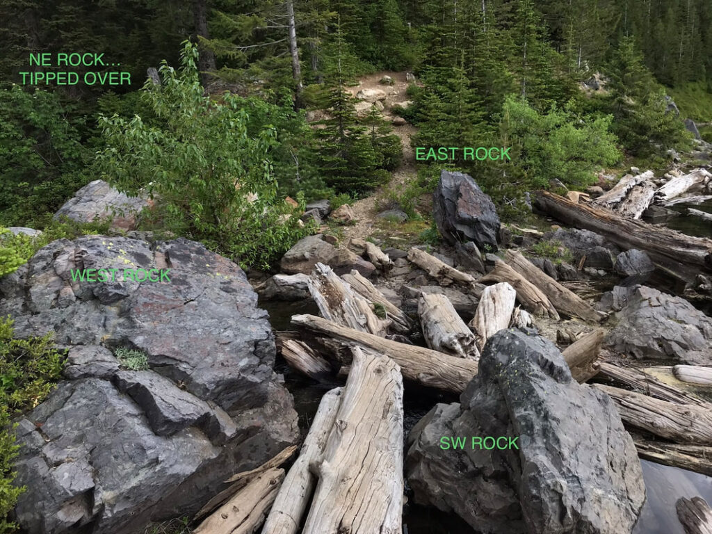
On June 28, 2024, I hiked into Lower Stevens Lake again to search for clues and found four large boulders. I believe the miners constructed the 8-foot-tall log dam using these boulders to hold the logs. The image shows how the northeast boulder shifted out of place at some point and is now behind the tree. I believe the tipping of that rock caused the East Fork Willow Creek flood.
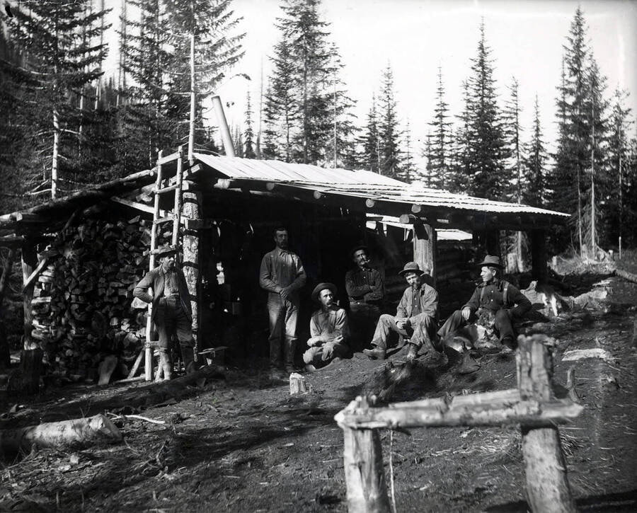
MULLAN FISH & GAME CLUB AND THEIR CABIN AT LOWER STEVENS LAKE
As I was doing research about the Stevens Peak area, I came across old newspaper articles about the Mullan Fish & Game Club. I discovered that the club had started a program to stock Silver Valley lakes in 1912. They ordered as many as 200,000 fish fry to be planted in the fall in many lakes and streams.
For “Twin Lakes” (another name at the time for Stevens Lakes), the club had to haul the fish fry into the lake in containers on their backs. About the same time, the club proposed building a log bungalow at Lower Stevens Lake, and the United States Forest Service (USFS) proposed building a cabin between the two lakes. That USFS proposal also included a plan to make the upper East Fork of Willow Creek between the lakes more inhabitable for fish to spawn.
The club’s cabin turned out to be popular, and they proposed a second women-only cabin at Lower Stevens Lake. However, I found little evidence as to where the second cabin was built. In 1928 most of the Stevens Peak area burned, and the cabin in question became history. The only images I have found of the “ladies” cabin do not give a clue to where on the shoreline it existed. But having hiked all around the lake many times, I have determined it had to be on the very first flat spot as Trail #165 arrives at the lower lake where a fire pit has been constructed.
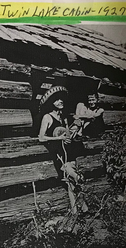
The USFS eventually built another cabin with a lookout on the Stevens Peak summit and connected it to the Mullan Fish & Game Club cabin via a telephone line. The only evidence I have found of the summit lookout is really weak, but knowing the area as well as I do, I found a historic image that shows what looks to be a rectangular structure on the summit.
I have continued visiting the Captain John Mullan Museum in Mullan, Idaho, to pore over the albums of newspaper articles for more details about the history, mine works and historic structures of the Stevens Peak and Stevens Lakes area. Visit my website for the latest research results and information. Inlandnwroutes.com/upper-and-lower-stevens-lake.html
Author’s Acknowledgments: Chic would like to thank the Captain John Mullan Museum, Bud Koski who turned him on to the Butch Jacobson History Albums and Miss Nellie Stockbridge and the Barnard-Stockbridge Collection at the University of Idaho Digital Archives for help with his research.
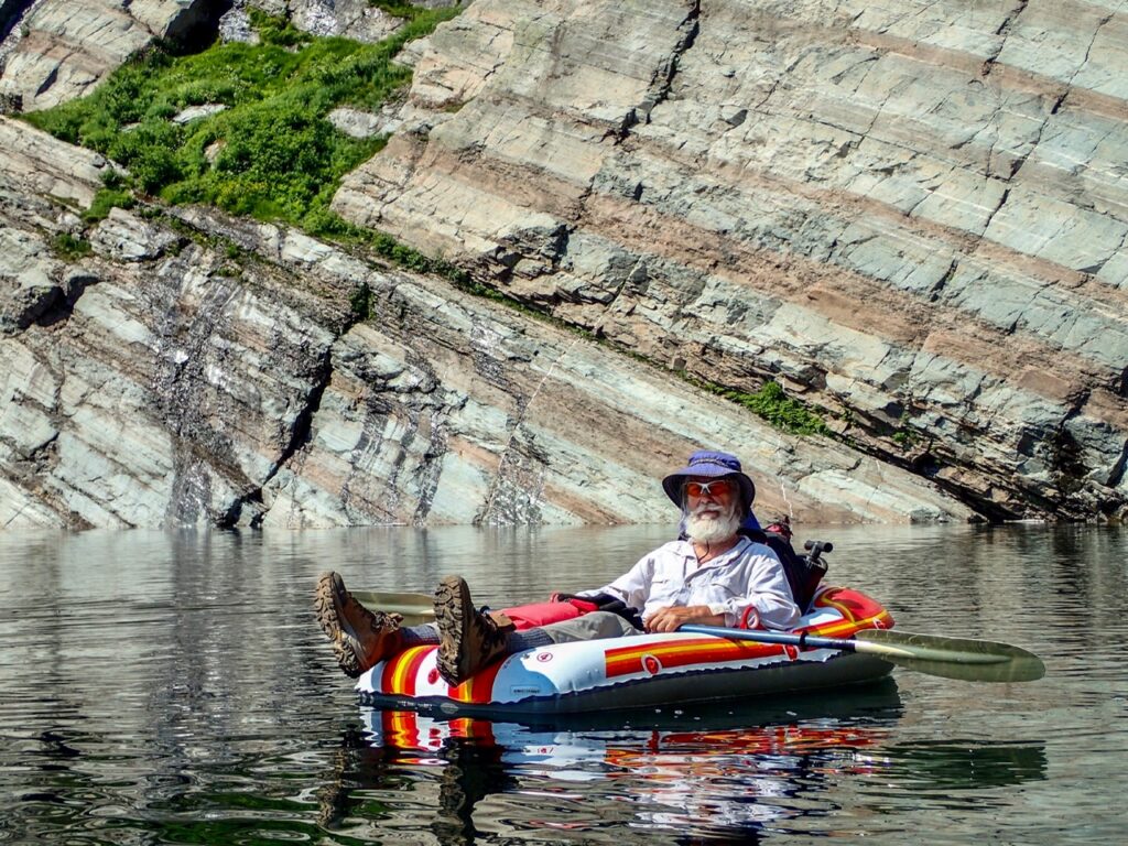
Chic Burge was born in Spokane but moved to Coeur d’Alene then on to Kellogg to be closer to the mountains and Silver Mountain. He joined the Spokane Mountaineers in 1984 and has served the organization in many capacities. “When the Historian position opened up, I jumped on it and spent three years organizing many boxes of archives,” says Chic. “In 1991, while working at the Camera Corral in Coeur d’Alene, I was asked by a USFS ranger if I would be interested in adopting Upper and Lower Stevens Lakes. I said yes, on one condition…only if I also get to adopt Lone Lake. Hence my love for this unique region has been my passion.” In 2018 he convinced fellow Spokane Mountaineers member David Crafton to help him create the Inlandnwroutes.com website.