As fall approaches and the weather starts to turn, so do the aspen in northeast Oregon’s Wallowa Mountains. Pockets of colorful trees dot the Wallowa valley, turning vibrant shades of yellow, orange, and red once the temperatures start dropping. But while you’re likely to see the tree’s brilliant fall foliage, there’s one thing you aren’t likely to run into in autumn: crowds. Take advantage of the solitude to explore the spectacular Lakes Basin on this 32-mile loop, which showcases the best the Wallowas have to offer.
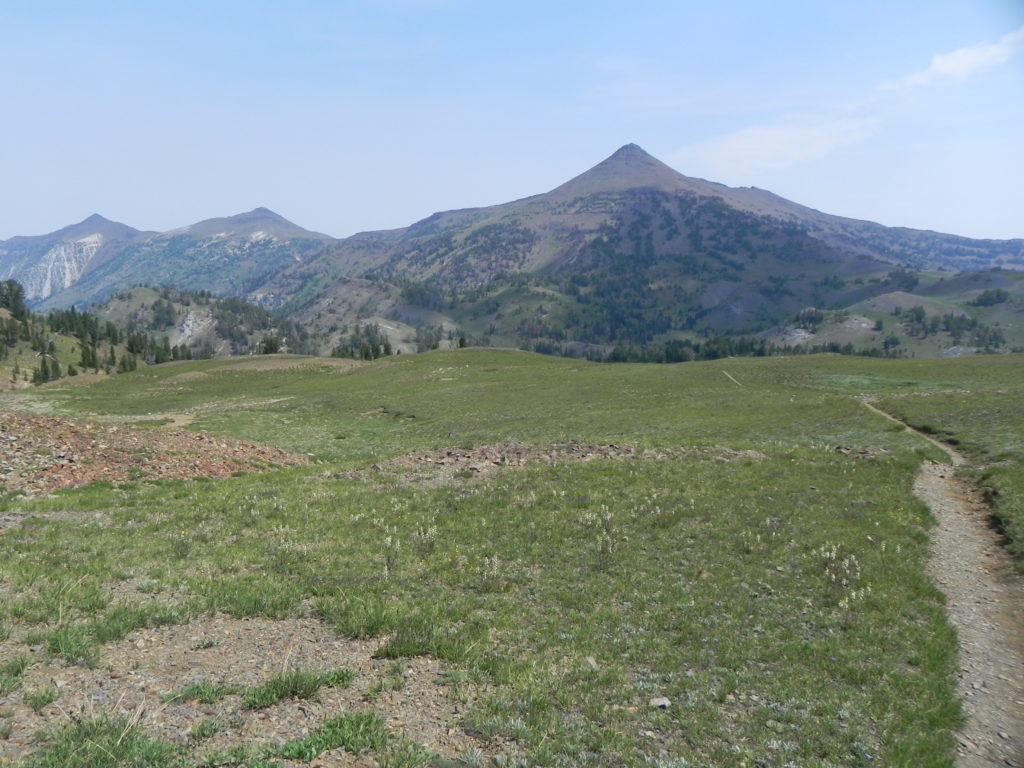
From the Wallowa Lakes Trailhead ($5 parking fee or Northwest Forest Pass required), start hiking up the East Fork Wallowa Trail. The grade is gentle, and the trail passes through several meadows that open up to views of conical-shaped mountains carved from sedimentary rock.
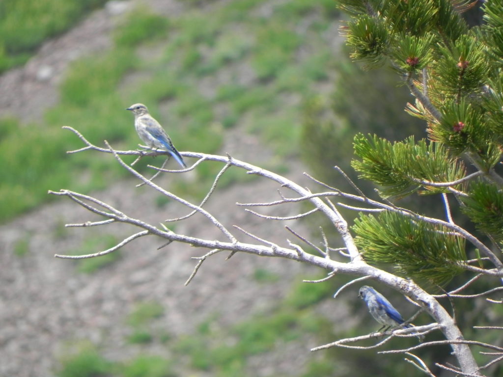
Reach Aneroid Lake at 6.4 miles, which is a great spot to camp if you got a late start from the trailhead. It’s also a great spot to fish because the state stocks rainbow trout here every two years. Continuing up the trail, you’ll reach a broad alpine plateau overlooking Jewett Lake near mile 8, tucked in a depression at 8,300 feet. Jewett Lake is a spectacular spot to spend the night, though the lack of cover makes it an undesirable campsite in bad weather.
At 8.6 miles you’ll make a right onto the Polaris Trail and ascend to panoramic views atop Polaris Pass at mile 12.6. Hopefully you’ve got a good pair of hiking poles because you’re about to enter switchback purgatory—over 50 switchbacks drop you 2,000 feet to the East Fork Wallowa River below.
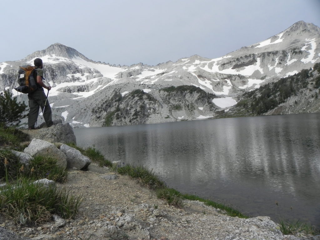
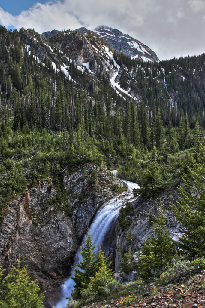
Frazier Lake, near mile 15, sits at the foot of a string of waterfalls cascading down a granite cliff and has several good campsites. But if you hike 2.5 miles farther to Glacier Lake, you can camp amongst the bonsai-like trees of the Wallowa’s alpine zone. Take your pick—you can’t go wrong.
When you wake in the morning, you’ll likely encounter the reason many people avoid the Wallowas in October—temperatures drop well below freezing at night, and mornings can be frosty. But instead of hiding in your tent, embrace the crisp autumn air by brewing a pot of coffee and wrapping yourself in your sleeping bag on the lakeshore. Watch the morning mist drift across the surface of the water as the first warm rays of sun peak over the horizon. Just don’t linger too long—you’ve still got some walking to do.
From Glacier Lake, the trail climbs to Glacier Pass at 8,500 feet before descending into the popular Lakes Basin area. The trail twists and turns for roughly 6 miles through the Lakes Basin, passing too many emerald lakes and spectacular campsites to list separately. The trees are sparse in this boulder-strewn landscape, and the glacier-scoured granite is speckled with numerous ponds and potholes. Several loop trails snake through the basin, making it a great place to explore for an afternoon after you’ve set up camp.
Eventually, you’ll have to leave the Lakes Basin and descend to the West Fork Wallowa Trail near mile 26. Follow the river down valley for roughly 6 miles of easy walking back to the trailhead.
Day Hiking Oregon’s Largest Nature Reserve
If the mountains aren’t your style, then drop into the lowlands and take a walk in Oregon’s largest nature reserve. The 51-square-mile Zumwalt Prairie explodes with lupine, camas, and balsamroot wildflowers in the spring and preserves one of the most intact bunchgrass prairie ecosystems in North America. From the Duckett Barn, set out on Patti’s Trail—a 2.3-mile loop that passes through shallow drainages and swaths of native prairie. In warmer months, butterflies can be found in abundance here foraging amongst the wildflowers. Look for the regal, orange and black Milbert’s tortoiseshell butterfly or the readily identifiable yellow and black wings of the western tiger swallowtail. Songbirds and raptors—like the western meadowlark and ferruginous hawk—are abundant, too, and are one of the main reasons this property was initially purchased and set aside by the Nature Conservancy.
From Enterprise, drive on Highway 82 south for 3 miles and turn left on Crow Creek Road. Drive 5 miles and turn right on Zumwalt/Buckhorn Road. Drive 14 miles and turn right on Duckett Road. Drive 1.4 miles and park at the Duckett Barn, which has a parking lot and an information kiosk.
Ice Lake Weekend Hike
Not feeling up for a 32-mile loop? Consider the 14.6-mile roundtrip hike to Ice Lake. You’ll still get the alpine lakes, fall color views, and high craggy peaks for a fraction of the effort.
From the Wallowa Lake Trailhead, head up the West Fork Wallowa Trail through lush forest for 2.5 miles. Turn right on the Ice Lake Trail and cross the gurgling torrent on a rustic wooden bridge. Switchback up the mountain for 4.8 miles, passing sparkling waterfalls. To minimize your impact, set up camp at least 200 feet from the shore of Ice Lake, set beneath the 9,826-foot granite summit of the Matterhorn, one of the tallest peaks in the Wallowas.
Scrambling up the Matterhorn is a popular, non-technical climb, but be sure you have enough time and the right weather for it—the climb takes at least 4-5 hours roundtrip from Ice Lake. The view from the wind-scoured summit is worth it, extending across northeast Oregon to the dry ridges of the Blue Mountains and the jagged defile of Hells Canyon.
When you’ve had your fill, retrace your steps the next day to return to the trailhead.