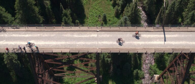
Now that the hot and sunny summer is but a recent memory, about the last thing on anyone’s mind is winter. I will admit that fall is a nice time of year, with the colors changing and the weather getting cooler; but for those who yearn for the white stuff, nothing is more frustrating than waiting for the return of winter. Yeah sure, we have football to watch, kids’ school activities to attend, and any number of other distractions to keep us occupied. But as each day gets shorter, the countdown to the upcoming ski and snowboard season creeps into our everyday thoughts. With that in mind, here is what the weather gurus have to say about what we can expect for the upcoming ski and snowboard season.
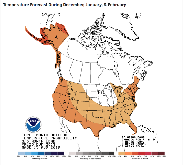
National Oceanic and Atmospheric Administration (NOAA)
At the time of this writing, the wicked smart folks in charge of predicting the weather for the government have yet to publish their official winter weather forecast, but their mid-summer projections don’t look too bad. For the PNW, we can expect a 50/50 chance of El Niño this year, but they included a caveat that this ratio could drop as we move into the fall and early winter. Temperatures are expected to be higher than normal during this time, with average to less than average precipitation. That said, we can expect a slow start to the season, but all bets of this trend continuing are off the table as we move into December and January with the El Niño weather pattern possibly weakening towards the end of the calendar year.
Office of the Washington State Climatologist
The crew that forecasts our great state’s weather seem to have a little better news for us, though it does mimic NOAA’s forecast a little. They are reporting that weak El Niño conditions are still present in the Pacific Ocean, but should shift to more neutral conditions as we approach late fall and early winter. Based on this, we can expect normal precipitation and temperatures at the start of the season, with typical patterns developing in January and February as the trend of an El Niño weather pattern continues to weaken.
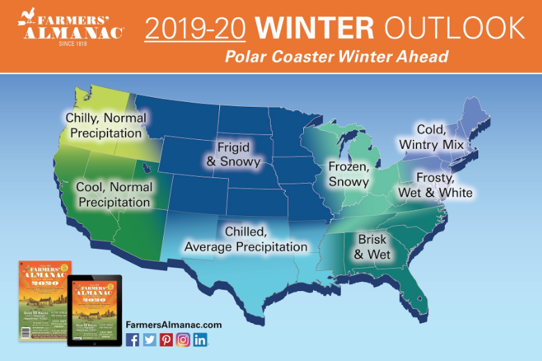
The Farmer’s Almanac
And the news just keeps getting better. The Farmer’s Almanac is predicting chilly temperatures and normal precipitation for all of Washington State. Once you hit the Idaho border, though, things get real interesting, as they are forecasting that this is the western edge of what will be a massive zone of frigid and snowy weather. Any slight shift westward and we could be looking at a season to remember around the Inland NW.
The Old Farmer’s Almanac
One look at the Old Farmer’s Almanac weather forecast map should put a smile on your face. For the western part of the state, it says “Wet or Worse.” Once you head east of the Cascades, that icon is replaced with “A Parade of Snowstorms.” Who doesn’t love a parade of snowstorms? Additionally, this iconic resource says, “This snow-verload will include storms pummeling Washington State. For the normally rain-soaked Northwest, this could mean a repeat of last winter’s record-breaking extremes, including the Snowpocalypse that dumped 20.2 inches on Seattle in February.” Yeah, you read this right—the terms snow-verload and Snowpocalypse both used in the same paragraph. Anyone remember last February? Took my legs a month to recover from the epic conditions we experienced in the shortest month of the year, so I’m all in if history repeats itself.