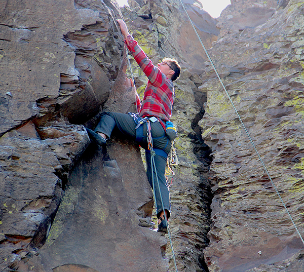
For the 13,000 or so years before Frenchman Coulee became a wildly popular destination for Northwest rock climbers, a striking formation of basalt spires stood as a graceful monument to the astonishing power of water and ice. The massive pillars are still here. It’s just that on any warm day, and many cold ones as well, fit and well-equipped people are attaching themselves to these forty-foot walls of stone.
At first sight it’s hard to trust what you’re seeing. Known as “The Feathers,” this formation of exposed basalt crystals barely withstood a succession of devastating floods. From the air, it looks as though a creature with jaws the size of the Rose Bowl has taken two bites from the coulee’s upper terrace. The Feathers somehow survived as a gently curving causeway between the bite marks. There are places where you can easily walk from one side to the other, stepping through gaps between the massive crystals.
What unfolds beneath The Feathers is a deep, bicameral gouge in the earth. The gaping crevasse in the bedrock was created as rampaging, late-Pleistocene flood waters burst out of what is now called the Quincy Basin, a broad area—well over 1,000 square miles—that encompasses most of Grant County. At its exit, just north of what is now Vantage, Wash., Frenchman Coulee functioned as a giant nozzle, directing the flood waters at a 90 degree angle across the Columbia River, slamming with stunning violence into the base of the Colockum Hills. The result can be seen in the magnificent gorge at Vantage, with steep and sheer basalt walls, and from the high ridge east of the river, and in long views with layered dimensions to the north, west and south.
A bit closer to the ground, so to speak, is Nick Zentner, a geology professor at Central Washington University who has popularized Northwest geology with a series of lectures and video documentaries. The first chapter in his video series is devoted to Frenchman Coulee. Viewers meet him as he’s walking and swinging a small rock hammer, which he also uses as a pointer when he’s not using it to crack open stone. Wading through sagebrush to a ledge not far from The Feathers, Zentner declares this all to be “hallowed ground” in a historic scientific controversy, one ultimately resolved only a half century ago when the cardinals of American geology finally concurred that it was catastrophic glacial floodwaters—and not a slow grinding of commonplace geologic forces—that blasted out such massive spaces in the lower Columbia basin.
Zentner makes a point I will also insert. Frenchman Coulee is within a couple long golf shots from Interstate-90, yet 99.9% or more of the motorists who whiz past the Silica Road off ramp (exit143) are oblivious to what they’re missing. Perhaps because there’s no tourist money to be made in the coulee, there’s no hint of signage to let you know it’s there. Practically speaking, if you have time to stop at the Starbuck’s down the road in Moses Lake (or closer still, the Sage Bistro and coffeehouse off exit 151), you probably have time to exit here, take a right on Silica Road and then take a left on Vantage Road. You can then gasp at this important geologic landmark and gasp again at your first sight of The Feathers.
As Vantage Road winds past The Feathers, it descends more steeply toward the coulee floor, where hiking trails into both chambers are easy to access. With balsamroot and other wildflowers in bloom, spring would be a fine time to pack a lunch and bring a friend.
My most recent visit was on a day when a Pacific storm was lashing at the coast and the Cascades. I was hoping the incoming weather would reach the gorge because The Feathers are difficult to photograph in direct sunlight. Alas, as is almost always the case, the sun was shining brightly. Plan B was to find a path below The Feathers to the coulee floor. There’s a waterfall on the eastern face of the north chamber I’d photographed from above a year ago. I wanted to complete the picture, so to speak, from below.
The trail I followed brought me into a V-shaped ravine that opens up into the massive north chamber of the cataract. From this vantage point, the visual dimensions are staggering. A decent camera can take the picture, capturing the nearby rock faces as well as the distant giant blades of the Wild Horse wind farm, straddling the flanks of Whiskey Dick Mountain on the far side of the river. But only a soul can absorb the deeper dimensions the sight evokes.
I used to work there, across the river, in Kittitas County, when I was young. Back then I wrote the same kind of stories that beat reporters everywhere are expected to write. There were car, truck and boat accidents, suspicious fires, domestic disputes that were often sad but sometimes funny, and a massive ash cloud from Mt. St. Helens that tossed purple lightening bolts into the Yakima River canyon.
I was aware, even then, that I was patrolling an interval between two very different cultures, each with its own landscape and sense of identity. My grandfather, Gil, introduced me to this one, the high desert, his favorite trout streams near Dayton, and the precious, sacred stillness that inhabits places like Frenchman Coulee. He sold insurance, drove a Rambler station wagon and sometimes wore bolo ties. His oldest daughter would become a Wazzu cheerleader, and that’s how she met my father. I graduated from Pullman in 1979; there’s a crimson Wazzu jacket in my trunk.
On the other end of the cultural spectrum is Seattle, with its urban wealth, Pacific rim sophistication, and seemingly boundless opportunities—all surrounded by the verdant beauty of nearby mountains and Puget Sound. I think of Kittitas County as a land bridge between these two worlds, with its eastern boundary reaching the sagelands at Vantage and its western boundary reaching the alpine crest west of Cle Elum, where the traffic then spills into King County.
The cultural tension across this divide is genuine and is embroidered in the state’s politics. Overall, Washington is a deeply blue state. But conservative resentment toward Seattle and its overpopulated liberal suburbs is such that there is a formal (if far-fetched) secessionist effort, led by Spokane-area Republican legislators, that would create the state of “Liberty” between Idaho and the Cascades. When you unpack this, what you find is that “liberty,” for some, is about the freedom to discriminate against brown and gay people, to pollute air and waterways with impunity, and brandish assault rifles. If there is any grudging concession that people in Seattle are adept at technology and the arts, it’s offset with an attitude that wisdom and authenticity can best be measured by zip code. Yet, the dispositive rebuttal to this notion can be reduced to one statistic: of the 20 eastern Washington counties, a majority in 19 voted for Donald J. Trump. The lone exception was Whitman County, home to my alma mater. Go Cougs.
I ‘m unable to walk into the vastness of Frenchman Coulee without thinking about this. Last summer, a working group of scientists formally submitted their recommendation that we acknowledge we’ve entered a new geologic epoch. They propose it be named the “Anthropocene” to recognize the profound effects that humans are now causing and inflicting upon the planet’s environment. Their case for the designation is compelling, and—if we didn’t already know this—it identifies each of us as witting or unwitting participants in the profound damage being done to our environment, and other species, as a result of human consumption and pollution.
The more I think about that, the more affinity I feel for the hordes of young people from Seattle who come here, by the hundreds on weekends, to pitch tents in Echo Basin and climb The Feathers and other walls. For the most part, they share my love for this environment and an underlying appreciation for conservation and access. Our passport to epic places like this almost inevitably boils down to political struggles pitting private interests against the public interest in access and conservation. As with climbing big rock faces, it is not for the faint of heart.
The phalanx of basalt crystals at The Feathers has an arc to it that brings to mind the famous semi-circle at Stonehenge. The “bluestones” at Stonehenge were, of course, painstakingly assembled by ancient people. The Feathers stand as survivors to natural forces much more powerful than a thermonuclear bomb. It is remarkably improbable, this curving conga line of basalt pillars—1-2 crystals deep. Especially in the context of these odds, it is a moving, natural monument. If you and I were to fight for something important, and we were among the last standing for whatever that cause might be, we’d like the memorial to look something like this.
Feature photo: Feathers // Tim Connor