The hike from Trout Lake trailhead to Emerald Lake is, for the most part, a moderately-difficult, flower-lined trail featuring stately, old-growth Ponderosa pine and interesting rock outcroppings. The trail traverses a portion of Hoodoo Canyon, named for the rocky pinnacles that can be viewed both alongside and jutting out above the trail.
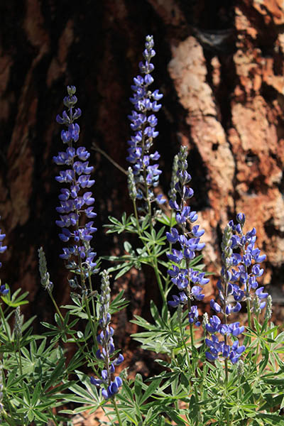
In the early miles the trail contours above Trout Lake, then offers glimpses of marshland on the canyon floor. Summer wildflower blooms provide splashes of color against the backdrop of pine bark and a carpet of pine needles.
With a starting elevation of around 3,000 feet, the trail tops out at a mere 3,500 feet, although a series of short climbs and descents along the way racks up an impressive nearly 1,800 feet of gain for the relatively short hike.
The route was made slightly more difficult in the spring of 2017, when an isolated slide approximately 2 miles from the trailhead created one very tricky section of trail. Hikers with small children and pets may want to turn back before the slide area.
For those who continue through the slide, there is a short scramble up a steep bank to negotiate the detour, and trekking poles will be useful to get around the difficult section. Plans are underway to repair the trail, but there is not an estimated time for completion.
An alternate access point from the Hoodoo Canyon trailhead is also currently under restricted access due to a mudslide on the Deadman Creek Road.
At around the 3-mile mark, the trail makes a sharp descent to Emerald Lake, where the water color really is a brilliant emerald green. The lake lacks an inlet stream, which concentrates minerals in the water (leading to the emerald hue) and creates a wonderful swimming temperature rarely found among alpine lakes.
Please protect the water quality by rinsing off sunscreen and bug spray away from the lake before jumping in.
Emerald Lake lacks true campsites, so a better option for anyone who would like to turn the hike into a camping trip is to take advantage of the free, first-come, first-served campsites at the Trout Lake campground and trailhead. This primitive campground offers picnic tables, fire rings, and an outhouse.
When You Go
Round-trip distance: 7.4 miles
Rating: Moderate
Maps: USGS Bangs Mountain and Boyds Mountain, or Colville National Forest map
Getting There:
Travel US 395 north through Kettle Falls and across the Columbia River. Turn west on the Sherman Pass Scenic Byway (Highway 20) and continue 5.2 miles. Turn north on Trout Lake Road, and stay left at major intersections as Trout Lake Road turns into Forest Service Road 20, which ends at the Trout Lake campground. The trailhead is just south of the boat launch, near the main kiosk.
Holly Weiler is a hiker, backpacker, trail runner, and skier. She writes the Hike of the Month column for Out There.
Give Back to Your Trails: Join Washington Trails Association for a new trail project at Mica Peak on July 31, 2018. Visit www.wta.org for details.
[Feature photo: Holly Weiler]