There’s nothing quite like starting a hike low in the drainages and walking up high to gain the viewpoint. It’s also a lot easier on hikers’ cars when the trail starts just off the highway. So try this challenging hike with a backpacking option as a way to save wear and tear on the trailhead car while also witnessing the way the ecosystem changes as the elevation rises. Halliday Trail starts just off the pavement and only a few miles south of the Canadian border, so it is easy to pair this hike with other nearby attractions on either side of the boundary on the Selkirk International Loop Road.
The trail offers numerous turn-around options to suit a wide variety of hiker desires and distance requirements. One of the best viewpoints along the length of the trail occurs at the .7 mile mark, when the trail briefly exits the forest at a rocky outcropping. Look to the west to see the prominent profiles of Abercrombie and Hooknose Mountains on the horizon, the second and fourth tallest summits in eastern Washington.
At 1.2 miles, the trail reaches the northern boundary of the Halliday Fen, a Research Natural Area within the Colville National Forest. The fen contains several rare plant species, but be sure to have protection from the resident mosquitoes if you decide to linger along the wetlands. It’s a beautiful spot that is best enjoyed while wearing a bug-proof head net!
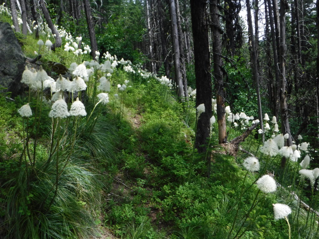
Beyond the natural area, the trail gains elevation and the forest changes as the surrounding area becomes drier. At the 4.2 mile mark, the trail reaches a junction with Red Bluff trail to the west, and the North Fork trail to the east. Day hikers should consider continuing an additional mile east along the North Fork trail. Until a few years ago, a raised boardwalk crossed a wetland here. When the boardwalk buckled and failed, the trail was closed for several years. During the summer of 2018, crews with Washington Trails Association (WTA) and Pacific Northwest Trail Association, with pack support from Backcountry Horsemen of Washington, wrapped up work on a trail reroute around the wetland that takes hikers closer to North Fork Sullivan Creek. This beautiful spot is both a good turn-around point for day hikers and a choice tent spot for backpackers.
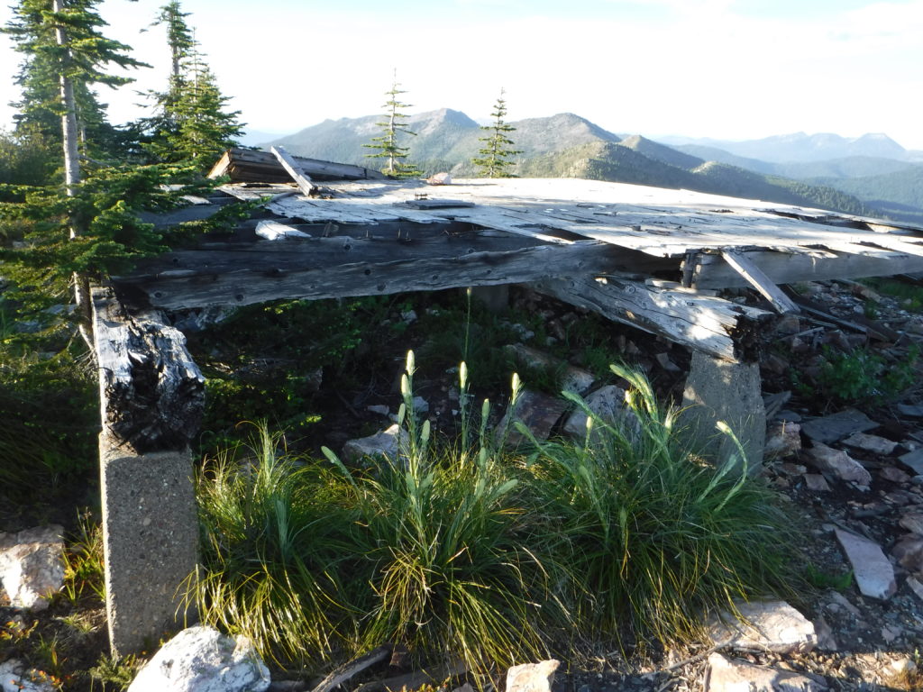
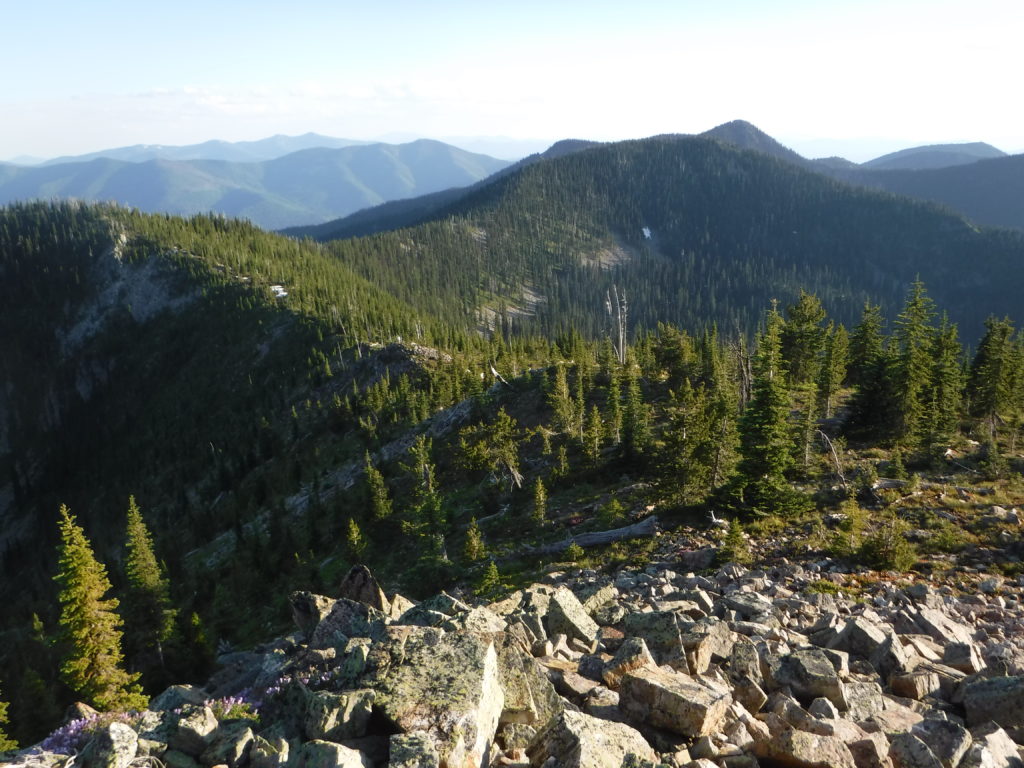
Backpackers and strong day hikers have a few additional options for extending the trip. Just .7 miles beyond the reroute, the trail enters the Salmo-Priest Wilderness. At the 6.3-mile mark, backpackers will find another campsite near North Fork Sullivan Creek. Those seeking views should top off their water supply here and continue to the 9.4-mile mark where the North Fork Trail intersects Crowell Ridge. There are several options for dry camping near the junction, including the top of the hill near the trail intersection, the site of an old fire lookout. Only a few boards and nails remain, but the views are unparalleled, with Canada a few miles to the north and the Idaho Selkirks visible to the east.
Round-trip distance: Up to a 10.4-mile day hike, or 18.8-mile backpack
Rating: Moderate to Difficult (depending on how far you hike before turning around)
Elevation gain: Up to 4,913 feet
Map: USGS Boundary Dam and Gypsy Peak
Getting there: From Metaline Falls, take WA 31 (the International Selkirk Loop Road) north 6.4 miles. Turn east on Forest Service Road 180. At the first junction, turn left to the trailhead.
Support Local Trails:Volunteer with WTA on a backpack trip to the nearby Shedroof Divide Trail, July 18-21, or at any of several day trips to Mica Peak Conservation Area.