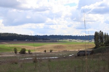
A stop on the Audubon Society’s Palouse to Pines Loop, this 164-acre Conservation Futures property is a good place to acquire an appreciation for bird watching. Identified as a migration corridor for 108 bird species, visitors should bring a bird book or download a good identification app to help determine what one is seeing. Don’t forget both binoculars and a camera when hiking the area, as most of the resident species will be seen on the water at the confluence of Peone Creek and Deadman Creek, or will be soaring high overhead.
From the parking lot, begin by hiking down the hill toward the wetland. In the spring it’s hard to miss the red winged blackbirds with their distinctive call among the cattails along the wetland’s edge. Turn left at the bottom of the hill and follow the wetland, watching for geese, ducks and other waterfowl. Hike up one of the small hills for a better vantage point for viewing other bird species, including several varieties of raptors. Red tail hawk are the most common species, but it’s not unusual to spot marsh hawks and bald eagles. Don’t be surprised to flush ring-necked pheasant while walking through the grass above the wetlands.
The conservation area boundary is marked by white posts along the property line. Turn around and retrace your steps for a short hike of approximately one mile that is sure to take at least an hour if one is stopping to identify the wildlife along the way. While dogs are permitted on leash, it’s a better choice to leave pups at home for this trek that preserves a fragment of the rapidly disappearing Peone Prairie. This hike is an exceptionally family-friendly one. No permits are required.
A printable map is available from the Spokane County Parks website. Also try the free bird identification app from Cornell University.
Getting there: Take the Argonne exit from Interstate 90 and go north on Argonne; continue north on Bruce. At the roundabout turn east on the Mount Spokane Highway. Continue just over 1 mile to the signed access point on the right. Drive .7 miles on the gravel access road to the trailhead on the left. Respect adjacent private property.
Give Back to Our Trails! Join in to help build a new trail segment to a scenic overlook far above the Little Spokane River on a hiker-only trail in Riverside State Park on April 8. Signup online at


