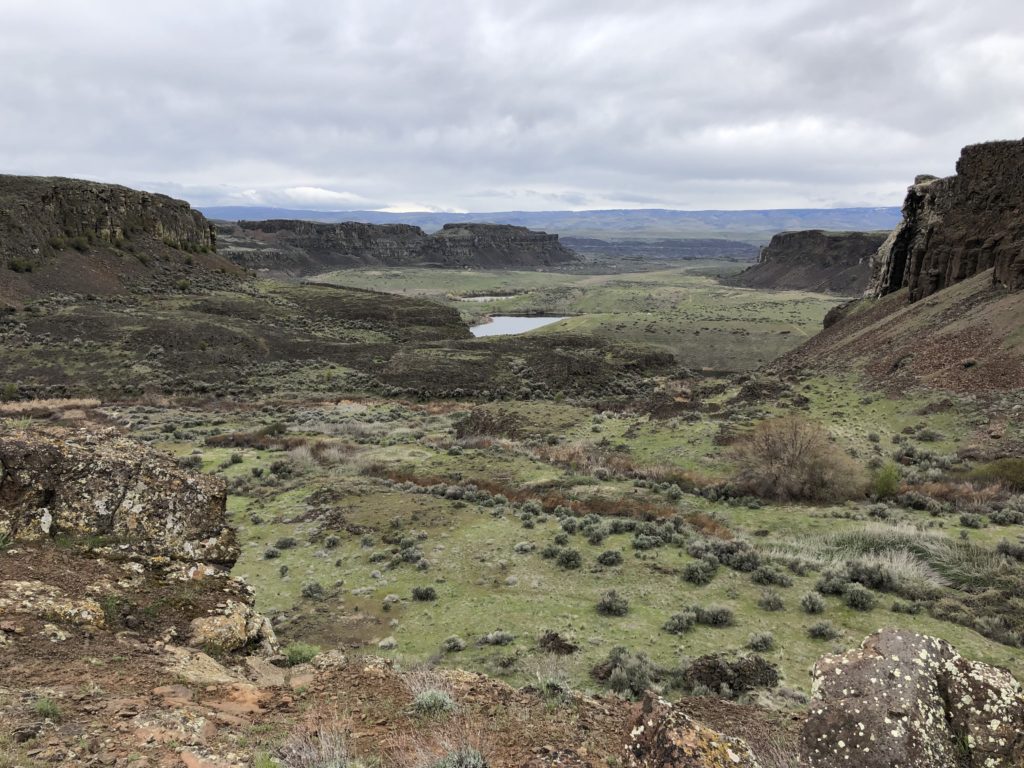
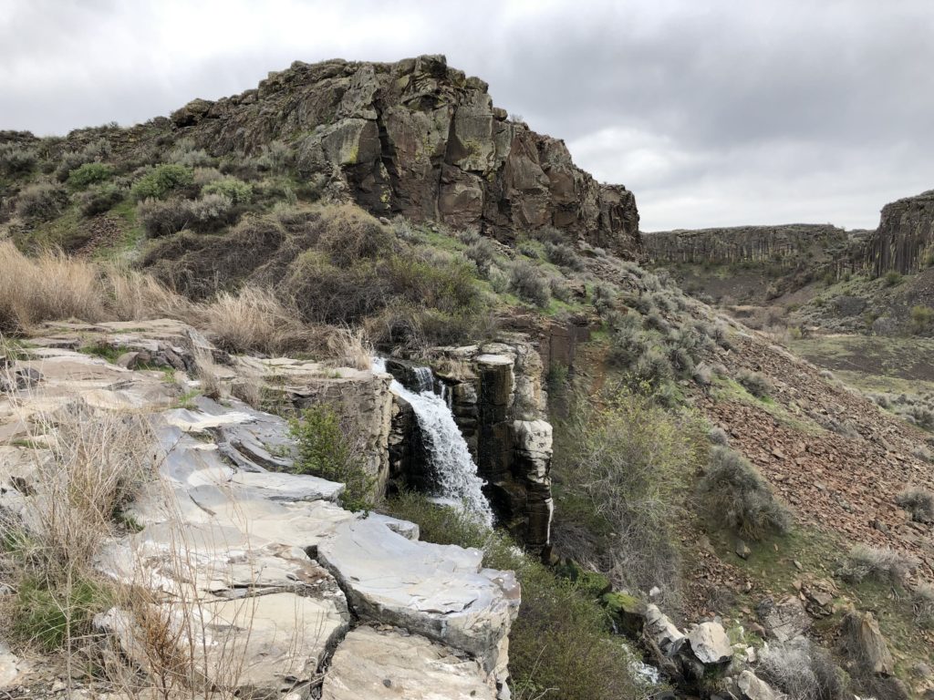
A coulee may not seem like an exciting thing to stand around and look at until you consider it an exposed history record. With their vertical basalt walls, the coulees of the Quincy Basin are unlike any other geological formations in the world. They provide an epic story to the educated viewer. On Sept. 21, local geology guru Ken Lacy will enlighten tour goers as he teaches them “how to read basalt” on a trip around the Lynch, Potholes, and Frenchman Springs Coulees.
As Lacy puts it, any geologist loves to look at a road cut—a cut made in a hillside when forging a road that exposes layers of geologic evidence. The Quincy Basin coulees are like road cuts made a long time ago by massive amounts of water.
“Because you can see all these layers in the basalt, you can go back in geologic time,” says Lacy. “You might look at a cliff that was formed by eight or 10 different lava flows that’s now exposed. Or find some pillow basalt, which means a body of water existed there when the lava was flowing.”
Lacy became an authority on the region’s geological features after going on countless tours with geologists. He’s also a member of the Ice Age Floods Institute (IAFI), a group with the mission of educating folks about the giant floods that shaped our land. His enthusiasm is energizing.
“The water was just screaming,” says Lacy of the flood that shaped the Quincy Basin. “It dug out solid rock and created these coulees as it spilled over Babcock Ridge and dropped 700 feet in just a few miles into the Columbia River. The water was in such huge volume and going so fast that it just tore this rock apart.”
On the Sept. 21 tour, Lacy will further explain how the coulees formed as he leads the group around the only place in the world where an ice age flood interacted with basalt to this effect. In fact, the area is unique enough that IAFI recently pitched the first National Geological Trail to congress. Our region is home to the only giant flood on earth that interacted with basalt, carving the dramatic landscape we see today. Congress authorized the trail, which is in its beginning planning stages and will be carried out under the National Parks Service. The trail will wind from deep in Montana to Astoria, Oregon, and will be sure to feature the coulees of central Washington as this tour does.
“One of the things that delights me more than anything else is when a person will say, ‘I’ve lived here for 45 years, and I’ve looked at such and such thing all that time, and I’ve always wondered how it was formed.’ They’re going to hear it all,” says Lacy. “They’ll learn how it was formed, why it formed, and why it took the shape that it did.”
If you can’t make the formal tour on September 21, you can plan your own fall tour of this dramatic landscape. Check out Visitwenatchee.org/listing/ice-age-flood-tours for maps and details.