Above the treeline and among harebell, paintbrush and columbine, my friends and I hiked a section of the Continental Divide Trail, a 3,100-mile mountainous route tracing the Continental Divide from Mexico to Canada. Ours was a working vacation. Last summer, we volunteered with the Wild Montana trail crew to mitigate trail washouts and damaging shortcuts, install cairns, and clarify a meadow meander.
With Swede saws, hard hats, pick axes, and eight new friends, I climbed from a rugged truck-camp at Storm Lake each morning for a week to shore up a trail section within the Anaconda-Pintler Wilderness, about 45 miles west of Butte, Mont.
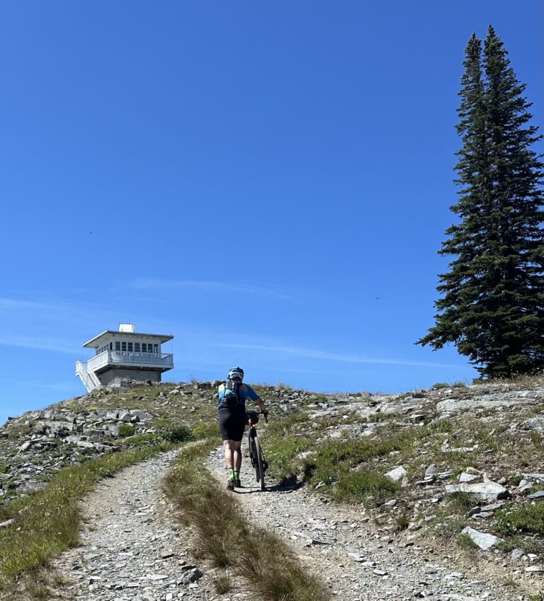
Each morning, a volunteer coordinator dished out daily duties. On one particular August day, we climbed 3.5 miles from Storm Lake to Goat Flat (8,200 feet elevation) to make the trail’s route more well defined, of which 980 miles wend through Montana and Idaho. Sun, breeze and ten-thousand-foot peaks pushed around cumulus clouds, while pink mountain heather brightened the rocky scape. We could see that Goat Flat’s eastern edge was a cliff—hidden when weather would sock in, limiting visibility.
“We’ll build cairns here and establish a good route through Goat Flat,” Sonny Mazzullo, the volunteer coordinator, told us. “It’s not always clear where to hike, so we will help concentrate the trail users through Goat Flat.”
Quartz diorite, tonalite, granodiorite and quartz monzodiorite make up the large rocks lining parts of the trail to funnel hikers away from the cliff and past the cairns we constructed, Middle Proterozioc and Paleozoic creations.
While many rugged-region land management agencies forbid visitors to build cairns, we were there with the USFS’s blessing and encouragement. The Continental Divide Trails Coalition partners with groups such as Wild Montana to maintain the trails and “sustain the natural, historic, cultural and scenic features of the CDT.”
With one midweek day off to swim and fish in Storm Lake during my trail volunteering, I took advantage of the time to pick wild raspberries, watch pika scurry across rock piles, and meet local hikers and long-distance thru-hikers. One day trekker lauded our group for defining the trail through Goat Flat, noting that she’d met a lost backpacker up there last summer during white-out conditions.
On personal hikes, I’ve traipsed over other parts of the CDT, designated by Congress in 1968 as part of the National Trails System Act that protects wild trails. At the time Congress established the CDT, it was the third major scenic trail in the country behind the Appalachian and Pacific Crest Trails. The CDT remains the least used of the three in part due to ruggedness, access issues, and weather. The Continental Divide separates watersheds of the Pacific Ocean and Atlantic Ocean thanks to the Rocky Mountains that can hold snow into August in some places.
Thanks to volunteers from Wild Montana, the Montana portion of the CDT will continue to be maintained so future trekkers can wander among the wonders of this high-alpine region. For trail work opportunities on the CDT, visit Wildmontana.org.
Jean Arthur hikes and writes about trails of the Northern Rockies from her Bozeman home. Her most recent book,“Top Trails Glacier National Park,” explores 40 trails in Glacier and Waterton Lakes National Parks, including some along the Continental Divide Trail.