By Blair Libby
A pair of bald eagles moved from ponderosa, to fir, to possibly a spruce, which rose up from corners of the lake as trout lookout towers. After a few explosive wing flaps during liftoff, they would glide, bodies as still as the glassy water that mirrored them. I followed their flight path on the water’s surface—distorted, yellow, hooked beaks trailed by rippled streaks of deep russet and white.
Eee-eee-eee- krakEEii! Weak piping notes broke their majestic quality. As patriotic Americans, or at least those who have watched “The Colbert Report” intro too many times, we expect eagles to release a scream that reverberates off canyon walls, beckoning us toward battle. That familiar Hollywood call actually belongs to the red-tailed hawk (Buteo jamaicensis), while the bald eagle (Haliaeetus leucocephalus) sounds more like a cross between a gull and a kitten. The duo took turns leading the other to the next roosting spot, punctuated by eccentric chirps. From my chosen sunning rock, I dipped my swollen feet in the lake, letting out an audible sigh as the water enveloped and lifted the grime from in between my toes. Ice bath ecstasy.
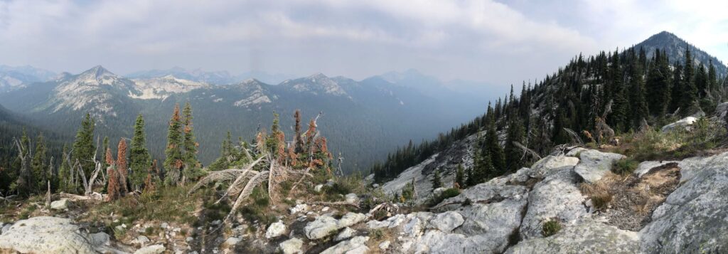
I was camping at Upper Ball Lake, in the Idaho Panhandle National Forest, closing in on the halfway point of my 1,200-mile trek on the Pacific Northwest Trail (PNT). From its start on the Continental Divide in Montana, the PNT loosely follows the Canadian border westward, crossing through three national parks, seven national forests, and some of the most biologically diverse and geologically stunning places in North America.
There’s something satisfying about ending a day’s hike on water’s edge. Perhaps it’s the practicality. You can fill up your bottles, even take a “bath.” And the big blue splotches on the map are easy-to-find landmarks.

Pinecones, twigs, and other arboreal offerings float like magnets, coming together in debris rafts before separating once again, passing you by on the way to some fate of decomposition. Human neighbors are few, save for the whirrr… plop of a casted line from an unseen angler nearby. Evidence of others appreciating the shoreline with you include a leaning, scratched-up tree marked by generations of black bears and an abandoned fire ring with the ashes of scavenged, then burned, branches. Alpine lakes are the true mountaintop guru—the gift after an arduous journey that begets more questions than answers.
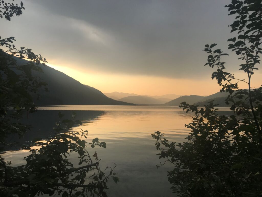
That evening’s mystical teacher, Upper Ball, is the highest of three glacially carved bowls beneath the aptly named Pyramid Peak. A massive headwall drops into steep talus slope before reaching the northwestern shore, where Volkswagen-sized boulders balance delicately like giant cairns. I camped on the south side, where I watched the granite glow gold, then pink, then blue, before it was silhouetted in moonlight.

Rising early the following morning gave me the chance to see the lightshow in reverse: indigo, to sherbet, and finally a scalding brightness that signaled a hot, difficult day of hiking ahead. Leaving the lake began the PNT’s most notorious bushwhack, which included 12 miles on exposed knife-edge ridgelines, steep hillside descents, and a perilous downstream walk on Lion Creek, where the bogs are more overrun with moose than big cats. I scrambled, cursed, fell, and desperately belted out Journey lyrics for levity, all the while hiking at half the speed of my usual pace. Eventually I reached some tread that was worthy of being called a trail. From there, another 11 miles to reach the campground at Upper Priest Lake.
While Upper Priest isn’t exactly “alpine,” it’s a backcountry alternative to the more crowded Lower Priest to the south. My campground for the night was a beach of small, round pebbles, which I shared with some kayakers who had paddled up the 2-mile thoroughfare that divides the sister lakes. Over donated beer, Vienna sausage, and astronaut ice cream, we agreed that the quieter scene in front of us was preferential. A common loon (Gavia immer) wailed in a sprinkle of rain that gradually muted the echoing tremolo. Through my open tent door, I observed the sun set again in a fuchsia mist over tomorrow’s passage, the Salmo-Priest Wilderness.
Most PNT thru-hikers, including myself, travel westbound toward the terminus at Cape Alava, Wash., the most western point of the lower 48. Besides the net elevation loss and avoiding an early autumn Rocky Mountain snowfall, I believe that we naturally aim ourselves for the water. Alpine lakes, wide river confluences, the Pacific. Our journeys on foot should end where we cannot take another step. At these breaks between landscapes, we’re forced to take a seat, rest, and soak our ears in the acoustics of a wet world. Those interludes remind us why we take the next step.
Originally published as “Backcountry Lakes: The Ambition of Water” in the July-August 2020 issue.
Blair Libby grew up around the West Coast and is currently pursuing an M.S. in Environmental Studies at the University of Montana, where his research focuses on traditional ecological knowledge. This summer he’ll be self-publishing and hand binding a collection of essays about his experiences while hiking the PNT.
For more infomation about the PNT, see this story from our May 2010 issue, “Hiking and Camping on the Pacific Northwest Trail: Three Great Routes for Crossing the Inland Northwest on Foot” by Callae Frazier and Dale Tessin.