Cover photo courtesy of Holly Weiler
At 1,794 acres and boasting more than 10 miles of trails, Mica Peak Conservation Area has been a strong addition to Spokane County Parks’ Conservation Futures properties. As a former working forest, the property contained numerous roadbeds from past logging operations when Spokane County acquired it in two phases in 2013 and 2018, but it did not include any purpose-built recreational trails. In the years since the land became a park, volunteers have invested many hours creating a network of singletrack trails that augment the existing doubletrack.
The most recent of these improvements is the Saltese Ridge Trail. A user-created route formerly ascended this steep ridge, but it was so steep that it became heavily eroded and exceedingly difficult for many trail users. Starting in 2021, a reroute was flagged to create a designed trail that includes some of the best views within the conservation area while avoiding Saltese Creek to the west and adjacent private property to the east. The new route maintains a steady maximum 10% grade, making it ideal for bidirectional, nonmotorized, multiuse travel. Hikers, bikers and equestrian users all share this trail and can use it to travel either up or down the hillside.
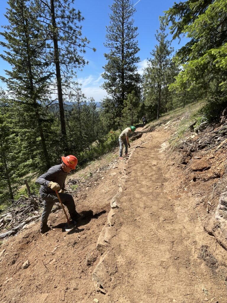
While many of the conservation area’s trails pass through second-growth timber and native shrubs, much of Saltese Ridge consists of open meadows beneath some of the largest trees in the area. Be sure to check out the giant ponderosa pine just above the fourth switchback. The area has excellent spring wildflower displays at your feet, and hikers should also stop to admire the views overlooking the Spokane Valley. Saltese Creek traces a route to Saltese Flats below, visible from this vantage point on a clear day.
At the bottom, Saltese Ridge connects to Moon Shine at the 1.5-mile mark. Throughout spring 2026, this is the only way to access the conservation area, as the Department of Natural Resources is conducting a timber harvest on adjacent property. During that time, the lower portion of California Creek Trail is closed and is expected to remain closed until July 2026. Saltese Ridge still includes an approximately 0.5-mile section of doubletrack until the Saltese Creek crossing and then ascends a little more than 1 mile before rejoining doubletrack that allows users to connect to the upper portion of California Creek. Numerous loop options are available by connecting Saltese Ridge to other trails in the system.
GETTING THERE: From Spokane, take Pines Road until it becomes State Route 27. Continue south on State Route 27 to Mica, then turn east on Belmont Road. Continue 4.3 miles to where Belmont Road reaches a dead end at the Mica Peak Trailhead.
Holly Weiler is the Eastern Washington Region Senior Coordinator for Washington Trails Association, leading many of the crews that helped design and build the Saltese Ridge Trail.