By Callae Frazier And Dale Tessin
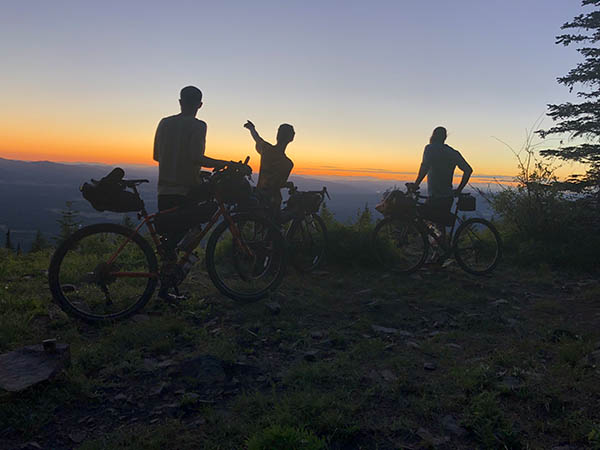
What inspires and encourages us to step away? Why do we intentionally present ourselves with physical, mental and psychological challenges in the backcountry? For some it’s the sense of adventure. Others are instilled with confidence by the experience. And many simply revel in the opportunity to spend as much time outside as possible. John Muir said, “The mountains are calling, and I must go.” For those who hear the call we offer three adventures to get away.
In 2009, we stepped away and reconnected with the landscapes, wildlife and people of the West, as we spent three months hiking the Pacific Northwest Trail (PNT). Designated in March of last year as a National Scenic Trail, the PNT joins the ranks of well-known routes such as the Pacific Crest, Appalachian, and Continental Divide Trails. As with its counterparts, the PNT offers stunning views, challenging trails and ample wildlife viewing opportunities.
Running between Montana’s Glacier National Park and the coastal section of Washington’s Olympic National Park, the PNT connects the continental divide with the ocean on a conglomeration of trails running just south of the Canadian border. Fully half of the PNT’s 1200-mile length crosses through the northernmost sections of the Inland Northwest (INW). East-west through-hikers enter the INW near Yaak, Montana, and exit at Ross Lake resort. Trekking across this span of country provides some of the most remote, diverse and truly wild experiences of the PNT.
Three through-trails that illustrate the PNT’s diversity are offered here. Since we experienced these trails moving east to west, we present them as such. However, all could easily be hiked from the west. Each route provides a unique backcountry challenge: scarcity of water, dramatic elevation changes, or bushwhacking off trail. They range from moderate to strenuous, take you on maintained and non-maintained (or non-existent) trails, and can be enjoyed as weekend, week, or longer excursions.
Thirteen Mile Trail, 16.5 Miles
Washington’s Colville National Forest encompasses 1.1 million acres of mountainous terrain and provides countless hiking and camping opportunities. We recommend this easy to moderate, weekend-long hike through the undulating mountains south of Republic. The experience will certainly dispel the myth that eastern Washington is flat. Yet, it will not change expectations about how hot and dry the region can get.
While the PNT generally runs just under the Canadian border, it makes a sudden turn to the south in the middle of the Colville National Forest. Distance hikers may question the need to make a wide diversion around Republic. The extra miles become worthwhile as the trails are generally in good shape and offer excellent scenery.
Thirteen Mile Trail 23 covers 16.5 miles of easily navigable terrain through a diversity of landscapes. Both its western and eastern trailheads can be accessed from Republic or Spokane with little difficulty. On the west, a large Forest Service sign on highway 21 marks the trailhead and associated campground. On the east, the trail begins unobtrusively from forest service road 500 where in 2009, a brand new wooden trail sign cheerily announces its presence.
From the east, hikers first climb through thick pine and spruce forest. Views are limited, but short understory and open meadows create a sense of spaciousness. Bear scat, strewn with berries in late summer, may cover the width of the trail.
After several dips through small drainages, the trail breaks out into a Ponderosa Pine parkland setting. Some of the sweet smelling trees are too big to get your arms around. Waves of mountains stretch to the horizon. This is a gentle, pleasant landscape.
The openness suggests easy camping opportunities. There are no limitations in the National Forest as to where you camp. However, the main challenge along Thirteen Mile Trail is water availability, especially late in the year. The Shelberg Cabin, located a quarter mile down the Bear Pot trail (four plus miles from the eastern trailhead), offers a fire pit, and flat camping spots, but no view. A stream persists to midseason directly in front of the cabin.
Several seasonal water sources near the eastern trailhead dry up completely by late summer. Even the “guaranteed” stream down the Bear Pot trail offered no respite when we hiked it in late August. Early season campers will have better luck. We found our first water source 10 miles in where the trail dropped into a ravine just short of Road 2054.
Historically, Thirteen Mile Trail was used as the center stock driveway for sheep moving from Ellensburg to high country grazing allotments. Center Stock Drive signs remain posted on trees. The forest service continues to grant cattle grazing allotments here. It’s important to treat any water collected along this route.
In contrast to much of the open, airy terrain of much of Thirteen Mile Trail, the final miles traverse down a steep narrow gorge to reach the western terminus. Towering granite cliffs close in, and the trail crosses noisy shale slopes in its descent. Where the sun baked you on the open ridgeline, in the shadow of the canyon you can chill quickly.
You are entering the “Grand Canyon of the Sanpoil” where the Sanpoil river has carved a narrow canyon into granite and basalt rock along Highway 21.
You’ll find a modest, but functional campground with pit toilets at this trailhead. The facility is co-managed by the forest service and the neighboring Colville Indian Reservation. Don’t be fooled by the un-lidded garbage cans. Bears do roam here, and if you do not have a vehicle, hang your food.
Pasayten Wilderness – Tatoosh Buttes, 48 Miles
At the northwest border of the Inland Northwest, the 530,000 square miles of Pasayten Wilderness tantalizes with its wealth of backpacking opportunities. Because of its size and remote location, the Pasayten is best suited to week-long or longer excursions. We recommend a 48-mile hike that showcases the variety of trails, terrain and landscapes found in this impressive region while challenging hikers with its dramatic elevation changes.
PNT through-hikers traditionally follow Boundary Trail 533, the Pasayten’s northernmost route to Ross Lake. Our journey detoured to the Tatoosh Buttes on the advice of a backcountry ranger who alerted us to 1500 downed trees across the official route. As Jon Knechtel, director of the Pacific Northwest Trail Association explains, the “official” trail is constantly under revision. Route changes occur frequently, often due to closures or major trail obstacles. Always check local conditions before starting a long hike.
The Tatoosh Buttes Trail 485 provides stunning panoramas with 360-degree views on well-maintained trails. To access this majesty, use either of two north-south drainages, each powerful in their own right. From the east, enter through the Hidden Lakes Trail 477. The Hidden Lakes offer excellent trout fishing and ample wildlife. Look for tracks of bear, mountain lion, and deer along the shore. Robinson Creek Trail 478 provides western access.
The Pasayten offers both designated and dispersed campsites. Since our route took us east-west through the area we cannot speak about campsites along the north-south entry or exit trails leading to trail 485. But there are campsites and a staffed ranger station between Middle and Lower Hidden lakes. And experienced hikers know that years of use have led to the existence of many unofficial, yet well-established sites. Utilize these sites before creating new disturbances.
Trail 477 intersects the Tatoosh Buttes Trail 485 approximately 16 miles north of the trailhead. Trail 485 begins climbing westerly almost immediately. Gradual switchbacks do not account for the persistent grade. Legs and lungs will be tested here as you gain nearly 3000 feet in three miles. The effort will be well worth it when you reach the rolling ridgeline trail that takes you over the Buttes. Make sure to step off trail and climb to the top of the first butte. At 7,245 feet, the view is impressive. Mountains ring the horizon. Cathedral Peak pokes up to the east, Gilbert Mountain rises in the south, Jack Mountain towers in the west and Canada seems within spitting distance. You are truly on top of the world.
After a sojourn with this stunning landscape continue east on Trail 485. Sections wind confusingly through tree-less meadows, so keep an eye out for tall cairns (rock piles) stuck with white markers. Enjoy the trail as it follows contours and gently drops for approximately five miles across open meadows. You will glimpse peek-a-boo views of the Pasayten River valley along the way.
An extensive forest fire moved through the Pasayten in 2006. The remaining dead, charred trees stand out startlingly against lush undergrowth. In sharp contrast to the thickly forested valleys the open sightlines through branchless-trunks illuminate the landscape’s topography. We hiked the trail in September when brilliant purple fireweed cloaked large swaths of ground. Early season backpackers will enjoy brilliant wildflower blooms in the open meadows.
We chose to hike the Buttes trail in one stretch, but camping atop the ridgeline would provide stunning views. The best options for water will be near several lakes available by short side-trails. Keep in mind, all water may become scarce or unavailable late in the season.
Near the western terminus of Trail 485, the path rounds a finger of ridgeline and provides full views of the numerous glacier-shaped valleys emerging from the backbone of the Cascades. Be prepared for a challenging, knee-jarring plunge on seemingly endless switchback to the valley floor. Descending to the Middle Fork of the Pasayten River, the trail loses 1500 feet over only a couple of miles. The entire length of the Tatoosh Buttes trail runs 10.6 miles.
The terrain changes again in the valley floor, as the skeletons of pine trees give way to bottomland deciduous trees. This silty, clay-like soil can be muddy even late in the year. Be aware of high water levels earlier in the season.
In the valley, cross Lease Creek and follow the well-maintained trail across a hump of land to the junction with Robinson Creek-Middle Fork Trail 478. Trail 478 follows the Middle Fork upstream to Robinson Pass (6000 feet) before descending its namesake to the trailhead, 21 miles from trail 485.
Campsites can be found at most river or stream crossings in the river valley. Hikers might take a short detour to the West Fork of the Pasayten where they will find an economical campsite on the east-bank, and a lovely, roomier site across the bridge and slightly upstream.
Long Canyon Creek – Lion Creek Bushwhack, 24 Miles
Idaho’s Selkirk Mountains offer easily accessible hiking options in the northeastern Inland Northwest. The following multi-day, one-way hike across Idaho’s Selkirks begins and ends with only moderate difficulty along well-maintained trail. The middle requires the exciting yet strenuous task of finding your own path over the crest where no trail exists.
For PNT through-hikers from the east, the Selkirks rise formidably out of the lush Kootenai river valley. Hikers arrive in the region just south of Porthill, ID. (For weekend travelers or long-distance travelers in need of supplies or a respite from the trail we recommend a stop at Roy’s Place Pub and Store in Porthill, 208-267-8525)
For this region, the PNT Guidebook recommends taking Parker Ridge Trail #221 to “stay high for the views”. An alternative route recommended highly by sage locals, takes Long Canyon Creek trail #16. We pass this suggestion along to you. The Long Canyon Creek drainage remains the last major unlogged drainage in Idaho. Trail #16 runs 14 miles up Long Canyon Creek on gentle grades and superbly maintained trail. You are immersed in thick, old-growth cedar-hemlock forest. Under the ancient canopy sounds are muted, footsteps fall quietly on duff-covered trail, and fern dominated undergrowth resembles Western Washington habitats.
Approximately six miles from the trailhead dispersed campsites can be found tucked into the trees along the southern banks of the creek. Four miles further, just before crossing Long Canyon Creek more obvious campsites appear on the right. Additional sites are located near the junction with Trail #7.
We experienced Trail 16 during a three-day period of rain and cool temperatures and encountered only a handful of hikers. During nice weather, this section of the popular Long Canyon Loop trail will see greater use. However, few will attempt to bushwhack out of Long Canyon, over the Selkirks, and into the Lion Creek drainage in order to reach Priest Lake.
Excellent backcountry skills and a good map & compass (and knowledge of their use) are mandatory for this bushwhack. There is no cell phone coverage. This is rugged country, and inexperienced hikers could run into trouble quickly here.
Upon reaching the junction of trails 7 and 16 (14 miles from the trailhead), hikers must choose whether to continue up Long Canyon or ascend Parker Ridge to Pyramid Pass. The PNT Guidebook provides detailed maps and descriptions of both bushwhack options.
Pyramid Pass offers spectacular views and easier off-trail route finding because the vegetation is thinner at elevation. The cost is 1800 feet of brutal switchbacks climbing to Parker Ridge Trail 221. Once on top, follow the trail SE to Ball Lakes. Leaving the trail you contour the ridgeline for about a mile before dropping into the Lion Creek drainage.
In contrast, trail 16 is not maintained beyond the junction with trail 7. While only climbing 1200 feet to Lion Creek Pass, this is the more challenging route thanks to head-high thickets of alder, maple, and menzeisia. The trail looks good initially, and in 2009 at least a mile had been cleared. After that, you are on your own. Beware that in wet weather the shrubbery, and you, will be soaked.
Whichever route you select, as you descend into the Lion Creek drainage remain on the north side. Occasional old blazes teasingly suggest a current trail exists. It does not. Follow game trails and regularly check your route and position.
Without an established trail, you are forced to slow down. Small details become clear. Moose-munched shrubs become evident. Dark, damp piles of moose scat are plentiful. You pay greater attention to the terrain and learn to move through it more efficiently. You really appreciate those folks who build and maintain trails.
The upper half of the Lion Creek descent is the most difficult. As hikers near the western trailhead, a more clearly defined trail emerges. Campsites appear alongside the trail, as do signs of increased recreational use. Lion Creek is a popular area on account of its accessibility, deep pools and slick-rock slides.
Failing to complete the six-mile bushwhack from Long Canyon (four miles from Ball Lakes) to the well-maintained section of Lion Creek in a day will leave you searching for campsites. Thick vegetation limits possible tent locations. We squeezed our tent into a narrow patch of ground clearly trampled by moose.
After being fully immersed in trail-less wilderness, suddenly encountering groups ready to frolic in Lion Creek, or out picking huckleberries, can be disconcerting. We were reminded how close we were to actual civilization when we ran into and shared a meal with Dennis Maas, co-owner of Spokane’s Europa Pizzaria. With wilderness so close at hand, the time to experience it is now—before someone puts in a trail.
The Pacific Northwest Trail cuts through our own back yard. Whether tackling these backpacking sections or heading out for a day-trip takes some time to explore the wilderness close to home.
And when you do—be safe. Contact the local US Forest Service office for current trail conditions and check the weather before hiking to elevation. Leave a trip plan with family or friends. Pack the 10 essentials. Leave no trace. Heed the call of the mountains.
When You Go
Thirteen Mile Trail 23:
EAST ACCESS: From Republic travel 7.5 miles east on Hwy 20 to Hall Creek/County Road 99. Drive 5.3 miles south and turn right on Forest Service Road 600. In 5.0 miles you will see the trailhead on the right. WEST ACCESS: From Republic travel south on hwy 21 for 21 miles to the Thirteen Mile Trailhead/Campground on the left (this is 49 miles north of hwy 2). No permits required. The road distance to shuttle cars is 39 miles.
MAPS: USGS Quad – Edds Mountain, Seventeenmile Mountain, Thirteenmile Creek, Bear Mountain. USFS, Republic Ranger District (509) 775-7400
Tatoosh Buttes Trail 478 Loop:
EAST ACCESS is via the Hidden Lakes Trail 477. From Winthrop follow Okanogan County Road 1213 north for 7 miles. Turn left onto Forest Service Road 5130 (Eightmile Creek Road) and follow signs 17 miles to the hiker trailhead (end of the road beyond the horse trailhead). WEST ACCESS to Trail 485 is via the Robinson Creek-Middle Fork Trail 478. From Winthrop take hwy 20 west 14 miles to the Mazama turn-off and turn right. Turn left on Okanogan County Road 9140 and drive 9.1 miles to the Robinson Creek Trailhead. (USFS) Self-register for free wilderness permits at the trailhead where Northwest Forest passes are required to park. The distance to shuttle cars is about 50 miles.
MAPS: USGS Quad – Tatoosh Buttes, Ashnola Mountain, Slate Peak, Robinson Mountain, Mount Lago, Frosty Creek, Pasayten Peak, Lost Peak, Billy Goat Mountain;
Green Trails – #18 Pasayten Peak, # 19 Billy Goat Mountain, #50 Washington Pass
USFS, Methow Valley Ranger District (509) 996-4003
Long Canyon/Lion Creek Trail:
EAST ACCESS: From Bonners Ferry, ID travel 17 miles north on US 95 to Copeland. Turn west and cross the Kootenai River on County Road 45 which becomes the Westside Road. After 10.5 miles see the trailhead on the left, 0.75 miles past the Long Canyon Creek bridge. WEST ACCESS: Follow hwy 2 north from Spokane 53 miles to ID-57. Travel 51 miles north up the east side of the lake to Priest Lake State Park. Turn right immediately after crossing Lion Creek and travel 5 miles to the trailhead. The road distance to shuttle cars is 135 miles making the Priest Lake SP Campground a nice respite before or after the drive.
MAPS: USGS Quad – Smith Falls, Pyramid Peak, Smith Peak
USFS, Bonners Ferry Ranger District (208) 267-5561
Trail Resources:
Pacific Northwest Trail Association
www.pnt.org
Jon Knechtel, Director of Trail Management
(877) 854-9415
Pnt Guidebook
The Pacific Northwest Trail Guide by Ron Strickland, 2001, Sasquatch Books, Seattle
The Ten Essentials For All Backpackers
Keep Yourself Safe In The Backcountry!
www.rei.com/expertadvice/articles/ten+essentials.html
Leave No Trace
Protect our wild places for future adventurers
www.lnt.org