New and updated outdoor apps on your phone are perfect for finding new trails or exploring the outdoors in the Pacific Northwest. If you’re looking to flatten your own bulging curve during the COVID-19 pandemic, or if you want access to current trip reports and trail conditions around Washington, then you might consider some of the following apps for your smartphone.
TREAD Map
TREAD stands for Trails, Recreation, Education, Advocacy and Development. The TREAD Map app, based out of Wenatchee, combines all of the different user groups together, including hikers, bikers, horseback riders, and trail runners, so that various areas can be enjoyed responsibly. By combining information from land managers and local enthusiasts, TREAD Map offers up-to-date recreation maps on your phone with custom layers so you can get trail conditions, safety information, or even volunteer opportunities.
The app includes progressive ideas for adventure with outdoor community spirit. Mat Lyons, TREAD Executive Director, says the app is “one stop shopping for all trail users. [TREAD offers] real-time, hyper-focused trail updates from the people out there today.”
WTA Trailblazer
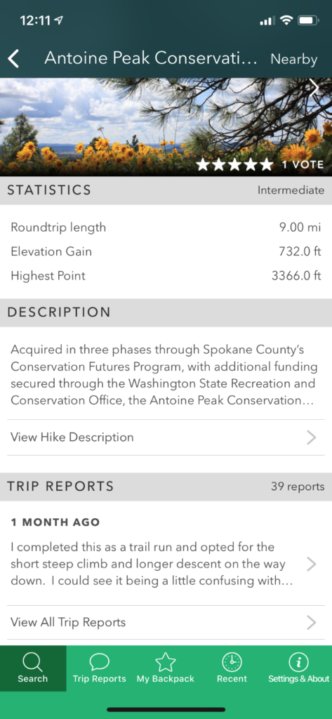
After miles and miles of helpful input, the genius Washington Trails Association Trailblazer mobile app provides several features that separate this app from most local guidebooks. For starters, users can search for trails by name, location, or relative difficulty (measured by length of trail and elevation gain), and for family and dog friendly hikes. You can also link to NOAA’s website easily to get current weather conditions and forecasts at the trailhead. Last but not least, the app’s My Backpack feature allows users to add and remove hikes from My Backpack, and the hikes saved in My Backpack are available even when offline. This is definitely a gamechanger.
Please note these mobile apps don’t replace guidebooks or paper maps. Not even close. Furthermore, some apps don’t work if you’re outside of cell service, and none of them work if your phone dies. However, these apps definitely provide easy, current, and convenient information necessary for finding new trailheads and new areas and discovering places that aren’t over emphasized by Instagram likes. These apps can also reveal recent forest fire damage or trailhead changes due to logging or erosion. Ultimately, the guidebooks are important, but the new apps are the wave of the future, and they’re a useful tool for discovering a new favorite hike in your backyard. Both apps are free and available on Google Play or the Apple Store.
GoSkyWatch
Saving the best for last, do yourself a favor and look into GoSkyWatch. After the tent is up, the mattresses inflated, and the flask is passed around, sit back and appreciate the night sky in a whole new way. Turn it on, point your phone at the sky, and start exploring. The app overlays the constellations with the images the Zodiac lines represent. Planets are color coded, showing their relative brightness to other stars for easy identification. It’s awe-inspiring and lots of fun with the right conditions.
Originally published as “Explore the Outdoors with Mobile Apps” in the September-October 2020 double issue.
Jon Jonckers has been a constant Out There contributor since 2006 and still enjoys sharing his love for the Northwest with anyone willing to listen.