4 Hikes in Local Natural areas
By Olivia Dugenet
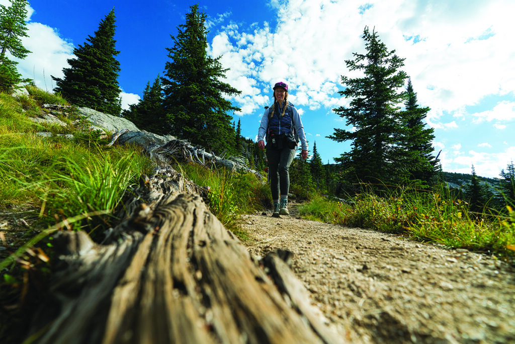
Cover photo courtesy of Kanisku Land Trust
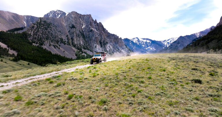
They don’t call it spring fever for nothing. When the big, dark Inland Northwest winter finally melts away and the whole world is green and growing, anything seems possible. Every step outside into the sweet, mild air feels like a celebration. Rain? Shine? It doesn’t matter. It’s a perfect time to get outside and explore some of our diverse local natural areas.
If you’re already experiencing gratitude for this season of abundance, why not add a note of thanks for the natural areas themselves? They all exist because sometime, somewhere, a group of people got together and worked hard to preserve these spaces before they were cordoned off and carved up into housing subdivisions. It is important to remember that we have a choice in how our communities are built. As anthropologist David Graeber once put it, “the ultimate hidden truth of the world is that it is something that we make, and could just as easily make differently.”
Here are four local hikes to appreciate the work that has been done to preserve some of our region’s natural areas.
Pine Street Woods (Sandpoint, Idaho)
Sandpoint, Idaho understands community. With support from Kaniksu Land Trust, the people of Sandpoint raised $2.1 million to save a beloved forest from imminent development. Now called Pine Street Woods, this fully protected 180-acre “forest for all” opened in 2019 and is open to everyone.
“What’s so great about Pine Street Woods is that it’s only about 10 minutes from downtown Sandpoint, but it feels really wild,” says Marcy Timblin, Director of Communications for Kaniksu Land Trust (KLT), adding that even with its feeling of remoteness, it’s very safe. She points out that all the trails are loop trails, so no one gets lost.
Pine Street Woods was originally part of an old homestead owned by the Weisz family, who held the 160-acre property for KLT while the organization raised money for the purchase. Another conservation-minded private owner, L.E. Krause, donated an adjacent 20-acre parcel.
The Pine Street Woods are strategically located adjacent to several other important pieces of land. The names Syringa Trail System and Sherwood Forest are used interchangeably to refer to the same privately-owned property. The owners have a conservation easement with KLT in a joint commitment to protect the land. VTT (Veló Tout Terrain), operated by Pend Oreille Pedalers, is a relatively new mountain bike trail system that connects with the Syringa Trail System/Sherwood Forest and Pine Street Woods. The private owners of another adjoining piece of land, Greta’s Segway, generously keep their trails open to the public. Together, this patchwork of properties forms a large and diverse area full of trails, forests and meadows.
“When you’re up there,” says Timblin, “it feels like it goes on and on forever.” Trails are available for all ability levels, from longer, more challenging hikes to walks that are accessible to wheelchairs, walkers and strollers.
This year, KLT opened the adjoining Sled Hill property. This privately owned land served as Sandpoint’s primary ski hill before Schweitzer opened in 1963 and has been a favorite sledding spot for decades. If hiking trails are still snow-packed in early spring, bring a sled instead. Visit kaniksu.org to join group hikes or connect with the friendly Sandpoint hiking community.
Directions: Drive west from Sandpoint on W. Pine Street. Pass the Selkirk School and Upland Drive. The Pine Street Woods access road is ¼ mile past the intersection of Pine Street and Hunt Lane on the left side of the road. Please respect posted speed limit and parking guidelines.
Post Falls Community Forest (Post Falls, Idaho)
Post Falls Community Forest is a true hidden gem. This 500-acre natural area just east of the Washington-Idaho border is easily accessible from I-90 and adjacent to the 78-acre Q’emlin (pronounced “ka-mee-lin”) Park and swimming area. The riverside preserve offers excellent hiking and rock-climbing opportunities. Several well-marked loop trails cover a range of terrain. The 2.9-mile Upper Falls Loop trail offers beautiful river views and options for birding or fishing. The 5.2-mile Post Falls Community Forest Q’emlin Park loop is moderately challenging with a bit of scrambling involved.
This community forest exists thanks to work that started more than 30 years ago. Today, after long-term collaboration from the Bureau of Land Management, Avista Utilities, the Post Falls Parks Department, the Post Falls Water Reclamation Division, and several private property owners, this broad swath of wild land along the Spokane River is permanently protected and available for the public to enjoy.
Directions: To get there via I-90, take the Spokane Street exit at Post Falls and travel south on Spokane Street to Q’emlin Park. As an alternative (with no seasonal parking fees), continue 3.2 miles south on West Riverview Drive to the Post Falls Community Forest Trailhead. The City of Post Falls asks that visitors park in designated lots only and take care not to block fire and emergency lanes.
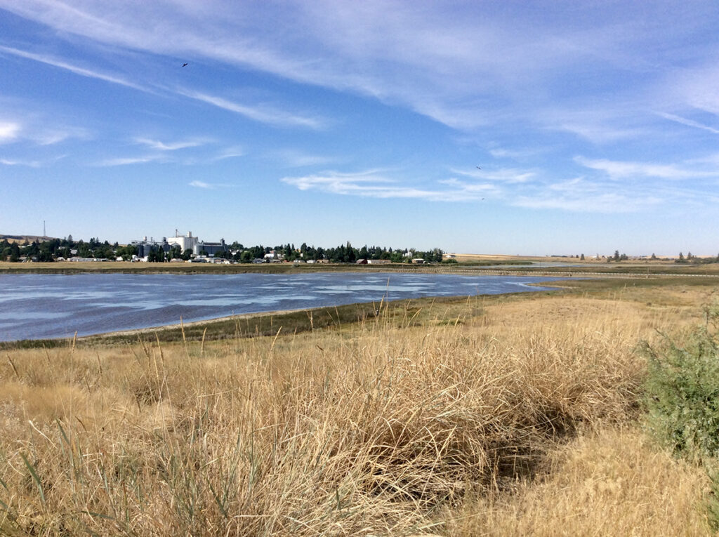
Reardan Audubon Lake (Reardan, Idaho)
Just 22 miles from Spokane, in the small town of Reardan, Audubon Lake is a lifeline for many species of birds during their spring migrations. Buffleheads, canvasbacks and northern pintails. Black-necked stilts, American avocets and northern shovelers. These are just a few of the winged travelers that rely on the 277 acres that encompass the lake, its surrounding wetlands, grasslands and other landscape features that provide vital habitat.
Back in the early 2000s, when the lakeside property was up for sale and slated for development as a lakeside housing subdivision, The Inland Northwest Land Conservancy and Spokane Audubon Society understood the damaging impact that would have on wildlife habitat and secured an option to buy the land. These organizations joined with Ducks Unlimited, the City of Reardan and the Reardan Chamber of Commerce to preserve the ecosystem and responsibly develop it as a wildlife viewing area.
Reardan Audubon Lake is now officially part of Audubon Washington’s “Palouse to Pines Loop,” which includes 51 spots around the Inland Northwest to view 215 out of Washington’s 346 annually recorded bird species.
There’s a lot of research to suggest that birdwatching, or even just listening to birds, brings stress relief and other mental health benefits. There’s a bit of a learning curve involved, though. If you’re new to birdwatching or would like to get started, check out Audubonspokane.org for free field trips and other fun and welcoming educational opportunities. You can find more information about Reardan Audubon Lake at Inlandnwland.org.
Directions: From Hwy 2 at the City of Reardan, go north on Hwy 231 three blocks to the SW corner of the property on the east side of Hwy 231.
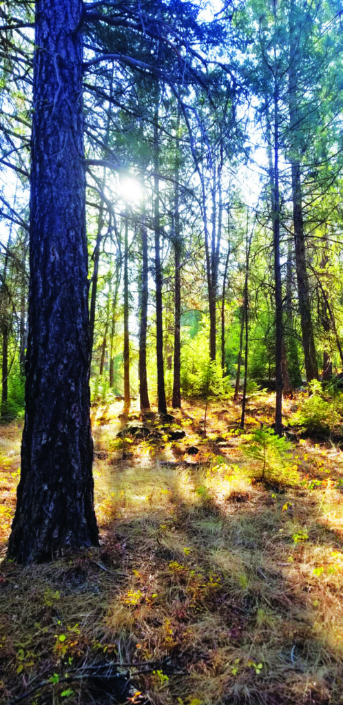
Haynes Estate Conservation Area, North Spokane (Spokane, Wash.)
Edward and Eloise Haynes bought property on the banks of the Little Spokane River in 1950. The undeveloped land, which served as an important wildlife habitat, stayed in the family for generations. When the cost of property taxes became difficult to manage, the owner considered developing the land as a housing subdivision, but neighbors and conservation experts recognized an opportunity to protect wildlife while also maintaining access to a beautiful community green space.
The Inland Northwest Land Conservancy, with support from the Friends of the Little Spokane River Valley, joined with the Haynes family to find an alternative. Through that effort, the Spokane County Conservation Futures Program secured the property in 2001. The Haynes family established a generous endowment to help maintain and care for the land. Today, the 97-acre Haynes Estate Conservation Area in north Spokane offers several short, well-marked loop trails for hiking, running, mountain biking and horseback riding. The beautiful half-mile stretch of river shoreline is a good place to take a fishing pole too.
Directions: At the North Spokane Y, take a slight right onto Highway 2. After 3.5 miles, turn right onto E. Farwell Road. Take the first left onto Shady Slope Drive for 1.5 miles, then turn left onto Leona St., which ends at the parking area. //
Olivia Dugenet is a Spokane writer who can often be found at her local natural area picking up trash, chatting with neighbors and running trails with her best friend Zizou the yellow lab.