By Nigel Davies
Cover photo courtesy of Nigel Davies
We celebrate finish lines, savoring those recovery walks over the Monroe Street Bridge every first Sunday of May after our city’s most iconic race. We joyfully refill water bottles on July 4th at the summit bathrooms on top of Mount Spokane. In those endorphin-rich moments, we tend to be wrapped up in our own experience, but twist the lens a bit and a deeper sort of grandeur comes thundering into view, from time immemorial right into the middle of your day.
Those Bloomsday runners slow-walking across the bridge? They’re suspended on cement and aggregate overlooking the Spokane River as it cascades over Miocene basalt flows. The cyclists on top of our home-town mountain? They’re all firmly planted on the Cretaceous granite roof of Spokane. Finish lines make nice caps for adventures. However, I encourage you to slow down en-route and think of the materials your tires over-lap, your heel strikes happen upon, and your eyes distractedly wander toward. The course of a day out is quite literally dictated by geology.
Our Vertical Topography
The landscapes of the Inland Northwest have been rather dramatically sculpted. Want flat adventures? Take a trip to Florida. While it’s possible to “hammer the flats” locally, some topographic impediment always punctuates Spokane activities. Take, for example, Bloomsday’s one-kilometer Doomsday Hill. Lifting famously from the otherwise level course, this 5% incline and 50-meter vertical rise, flanked by soft sand and gravel, is the stretch that will zap your legs on the Lilac City’s 12k spring jaunt. Or consider a pedal up Spokane’s White Road, where 17% ramps painfully deliver you from the downthrown side of the Latah fault in Hangman Valley to the hanging wall of the West Plains. Activities in the Inland Northwest invariably get geo-twisted into unintended vertical.
Boring Basalt? Look Again
Finding the top and bottom of a basalt flow is the first challenge. Start by looking at a local cliff face cut either by flood waters or human activity, and find a wavy horizontal freehand drawing running through the earth. You’re looking at a cross-section of ancient lumpy lava flows. Around 16 million years ago, long linear cracks in the Earth’s surface (North-Northwest oriented fissures) intermittently spewed lava, stacking layer after layer of lumpy basalt flows and filling the Columbia Basin up to 1,500 meters deep. The basalt that rests between these many old flows was crumbly, weathered, broken and pitted full of trapped gas pockets. Incidentally, these intra-flow openings store aquifer waters, so say, “Thank you, basalt” next time you fill bottles anywhere in the Columbia Plateau Aquifer System.
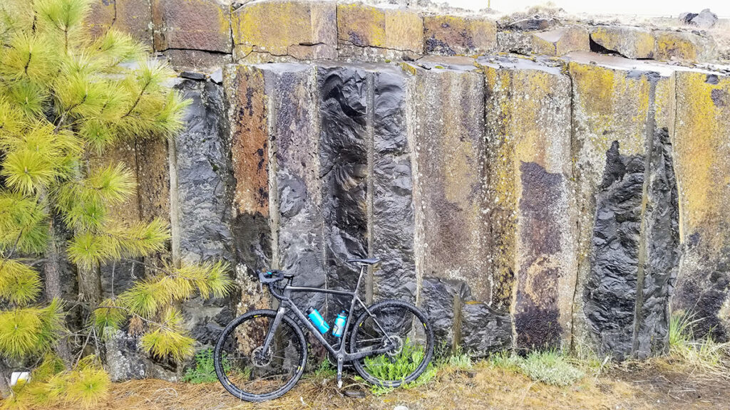
Columnar basalt jointing is the favorite texture of Inland Northwest landscape architects (see every welcome sign in Spokane). The mostly hexagonal cooling cracks occur in the centers of basalt flows. Water content and cooling rate dictate the size and scope of these cracks in a process similar to drying and cracking lake muds. East of the airport, the basalt flows have some of the best exposures regardless of DOT drilling and blasting (figure 1). A scenic option is Towel Falls at Escure Ranch where Rock Creek flows over the hexagons and down the vertical joints.
Pillows of Basalt
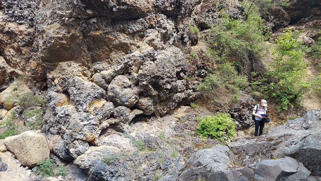
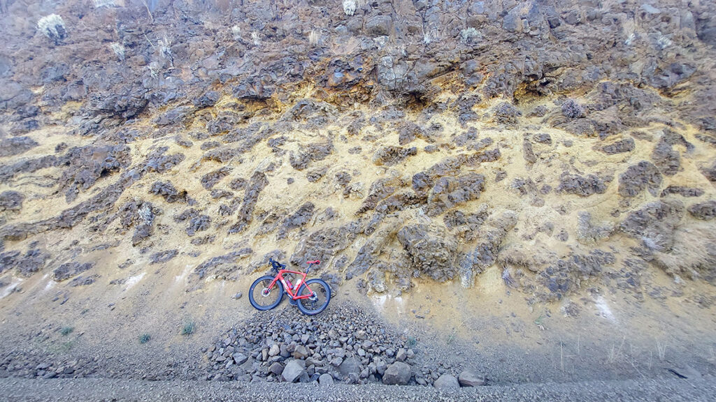
Where lava flows directly into water, get ready for a violently boiled muddy milkshake with crunchy pillow cookies. Thousand-year pauses between lava flows from the aforementioned North-Northwest fissures allowed basalt hummocks and lumps to fill with water and sediment. But subsequent lava flows stirred the pot, baking pond-side vegetation in a process called charcoalization (figure 2). Upon hitting the water, lava cooled rapidly into irregular bulbous rounds surrounded by tan-colored steam-churned sediment (called hyaloclastite), and commonly contained obsidian. Called “pillows,” these rounds have cooling rinds and cracked exteriors. A short hike down Deep Creek Canyon in Riverside State Park (figure 3) provides an excellent opportunity to discover countless pillows and 25-meter thick Latah exposure, as well as a premier climbing spot for those upwardly inclined. Along one of my favorite road bike rides, the 70-mile Rock Lake Loop south from Cheney, an eye-catching delta front of pillows can be found just west of Malden (figure 4).
What Makes One Trail so Different from Another
Hosting the Silver Valley, the Belt Supergroup is a big geologic deal in the Inland Northwest. It’s one of the best exposed examples of Mesoproterozoic rocks (1.5 billion-years-old) on the planet. The belt, made up largely of lightly baked (metamorphosed) fine-grained sedimentary rocks, often presents itself in massive exposed strata—see Glacier National Park. The belt is huge, covering 200,000 square kilometers across Montana, Wyoming, Idaho and some parts of Washington. The Caribou Ridge trails on the eastern shores of Lake Coeur d’Alene are an adrenaline-filled outing belt. Short sections of double off-camber tilled weathered bedding planes (called dip slopes) cascade riders and hikers alike toward the cliff edge. Stay safe when it rains.
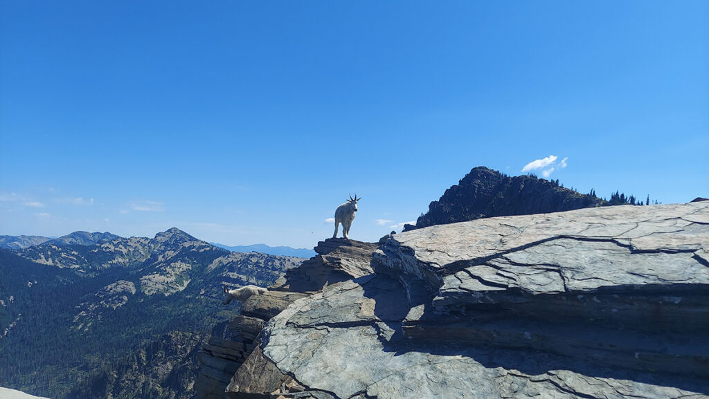
While the belt flattens in places, it is commonly deformed locally (figure 6). The 15-kilometer-thick package of weathered paleo North America has been torqued, twisted, intruded and tectonically deformed for the past 300 million years as Washington assembled. Along exposed sections of alpine ridge tops, it fractures and weathers to slabby, clinky scree fields, known as felsenmeer. Trails through these high-elevation quartzites are often wobbly underfoot (“that one moves”), but they also form paved pathways up to Scotchman Peak (figure 6). The same freeze-thaw cycle that created wobbling metasedimentary slabs generated blockfields that dominate the uppermost exposures of Mount Spokane, where 100-million-year-old granites with giant, blocky, white feldspars lead into trail 140’s and 290’s upper reaches.
The Inland Northwest landscape is tough, like its people. To survive a series of Ice Age mega-floods, you better be robust. Rocky Mountain granites and quartzites stand up to that test. Those tooth-rattling, speed-sucking, boulder and cobble fields commonly found at Wednesday Night Mountain Bike Races in Riverside State Park remain constant. The Missoula Flood waters that ripped west into today’s Riverside State Park between 18-14,000 years ago initially widened the basalt cliffs only to subsequently fill in the void with multiple terraces of silt, sand, and resistant boulders as transport capacity diminished. For those who attempt the 50k/25k/10k/5k Spokane River Run in the spring: wishing you strong ankles as you skip atop well-traveled metamorphosed basin and plutonic remnants.
Ever Changing Trails
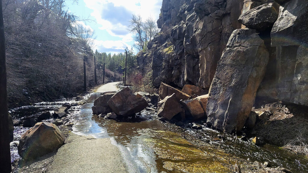
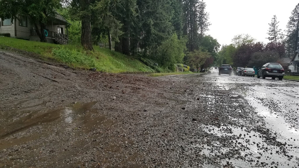
When encountering flowing water on a trail, most folks just walk or pedal around it and keep going. It’s unusual to think of the puddles as a way to experience geologic processes. Along the Fish Lake Trail, for example, the Cheney Fracture Zone breaks and fractures those lumpy basalt flows of the Columbia Basin, creating sediment fans that push swollen March streams trail-ward, wetting riders’ backs with rooster tails less than a mile from its Cheney conclusion. Additional impediments (figure 2) exist where soft Latah crumbles, dropping meters-tall basalt columns onto the trail, again diverting water path-ward and wetting panniers. Take care cornering post-storm, as high energy waters on Dover Road will spill their gravely contents onto Coulee Hite; similarly, Upper Terrace cascades runoff sediment onto Rockwood Blvd. (figure 7)
Plan Your Own Geology Adventure
The Inland Northwest is packed with geological wonder. Use all the bikes, shoes, boats, gear and even vehicles to get out and observe unique angles and speeds of passing geology. Check the resources in the sidebar to learn more about unique features of our local landscapes. You’ll be amazed at what is revealed when you exchange your finish line moment for the geology adventure en-route.
When displaced from teaching geoscience at EWU, Nigel can be found racing road, announcing cyclocross and aiding youth mountain biking while telling stories about rocks to whomever will listen. Upcoming gravel adventures loom large; from the Midnight Century to Rebecca’s Private Idaho, you can find Nigel “training” on dirt climbs or relaxing post ride with a recovery beverage.