Gravel adventure rides in Spokane County
By Bradley Bleck
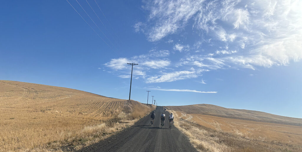
Cover photo courtesy of Bradley Bleck
One reason gravel biking is popular is because it taps into the joy many cyclists felt when they first learned to fly on two wheels. This joy can be found along the nearly 1,200 miles of unpaved roads in Spokane County. This abundance of gravel is almost too much of a good thing for the uninitiated.
To help with that, what follows are several rides, from beginner to advanced in order of difficulty, that can either be your gateway to gravel cycling or some new routes to explore. GPS information for your phone or cycling computer is provided for all but Saltese Flats.
Palisades Park (Spokane)
Close to the Spokane city center and a great place for novice gravel riders is Palisades Park. The essentially flat route, found by searching “Rimrock, Houston, Grove, Mission” on Ride with GPS, is 95 percent gravel if you ride it end to end. There are minor undulations and great views of the city and beyond. Parking is available at Greenwood and Basalt Roads or at Houston and Rimrock Roads, soon to be home to a new trailhead. There are six miles of mostly Category 1 gravel, making for up to 12 miles of out-and-back riding.
Saltese Flats Wetland (East Spokane County)
The Saltese Flats Wetlands offers 4.5 miles of trails around the wetlands, leaving from the trailhead on S. Henry Road, adjacent to the Saltese Uplands. Depending upon the time of year, you’ll be able to spy migrating waterfowl along with other birds and critters that make the area their home. The Category 1 gravel is largely flat, with two out-and-back routes.
Slavin Conservation Area (South Spokane County)
A step up in terms of difficulty starts and finishes at the Slavin Conservation Area. This 26-mile route has a little over 800 feet of climbing running through the meadowed plains, terraces and Ponderosa-lined buttes and scabland near Cheney. About 40 percent is unpaved. On Ride with GPS, search “Slavin Gravel” where you will find what is described here and both shorter and longer routes.
Green Bluff (North Spokane County)
A significant step up in terms of the challenge is the “Rotary Gravel Flamdangle” as found on Ride with GPS. The route’s 32 miles and 3,000 feet of climbing starts and ends at Big Barn Brewing on Green Bluff. With roughly 40 percent gravel, there are steep climbs, some over 13 percent (meaning 13 feet of elevation gain for every 100 feet traveled). This route showcases wide open fields, pastureland and forested dells. The surface is mostly Category 1 gravel. The steeper climbs will challenge all riders. It’s also one of the Lilac Century route options for this Rotary Club event held in May.
Moran Prairie (Southeast Spokane County)
On the Moran Prairie, there are countless gravel riding possibilities. If you search “Moran Prairie Valleyford” on Ride with GPS, you will find a 31-mile loop leaving from the Safeway at Regal and South 57th. This route is roughly 57 percent gravel, where you’ll tackle grades up to 15 percent. With nearly 3,400 feet of climbing, this is mostly Category 1 and 2 gravel, meaning washboards and loose gravel likely. Highlights include the Elder Road climb through the California Creek drainage and the Wood Memorial Cemetery, the final resting spot for many of Valleyford’s early settlers. Plan on it taking close to three hours if you are fit.
Spangle (South Spokane County)
One of my favorite gravel rides starts and finishes at the Harvester Restaurant in Spangle. Several routes can be found by searching “Spangle Gravel” on Ride with GPS. This description is a 36-mile option with 2,400 feet of climbing that is roughly 90 percent unpaved. This tough route will take at least three hours while traversing pastureland, creek drainages and rolling wheat fields. The longest sustained climb is just over a mile-and-a-half but the persistent and steep rollers will sap your legs. This is Category 2 gravel.
Antoine Peak
Another popular route is the “Antoine Peak Loop” on Ride with GPS. The route has about 3,200 feet of climbing over about 26 miles and is 70 percent gravel. The ride begins in the Antoine Peak parking area and the plains surrounding Mount Spokane before climbing the mountain’s forested flanks. There are three climbs over a mile long, the longest being 2.6 miles. A few paved miles along the Newman Lake shoreline provide some respite before the climb up Antoine Peak itself, which is single and doubletrack. Nothing is overly steep, but this is a more advanced ride. The gravel is Category 1 on summer and logging roads.
Mount Spokane
Next on the list of gravel challenges is “The Mount Spokane Gravel Loop” as found on Ride with GPS. Beginning and ending at Mount Spokane High School, this route covers 53 miles with over 6,000 feet of climbing. The route is roughly 50 percent gravel, some of it double-track (Category 3) through the shaded slopes of the lower mountain. You can bypass nearly 1,000 feet of climbing and a handful of miles if you skip the final paved miles to the summit. But do that and you’ll miss the views and the sense of satisfaction that comes with conquering the highest point around, along with the bathrooms and water at the top.
Once you begin exploring the nearly limitless options for riding gravel around Spokane, you’ll see new opportunities for cycling around nearly every bend in the unpaved road. Keep in mind that with many gravel rides there will be no services along the way, so bring the necessary food and drink and have someone along who has mechanical skills and the necessary tools to get everyone home.
Bradley Bleck last wrote about professional mountain biker Hannah Otto and the improving cycling scene in Spokane in the Spring Out There. He’ll be spending the summer riding one of his bikes in the Inland Northwest and beyond.