Let me be your concierge for a Northeast Washington hiking weekend this summer that includes hiking Thirteen Mile Trail, an overnight car-camping stay at Swan Lake and a visit to the frontier-like town of Republic, Wash. You will make lifelong memories.
Swan Lake Campground
From Republic, drive Route 21 south for approximately seven miles to Scatter Creek Road on your right. This road takes you to Swan Lake Campground, a family-friendly Forest Service site. A trail winds along the lake, offering ample opportunities for fishing and swimming. A large grassy area and docks in the water make this campsite especially fun for kids. Swan Lake is a quaint location filled with occasionally vocal loons. If this campground is full when you arrive, check out several other nearby Forest Service Campgrounds, including Long Lake, Ferry Lake and Thirteen Mile.
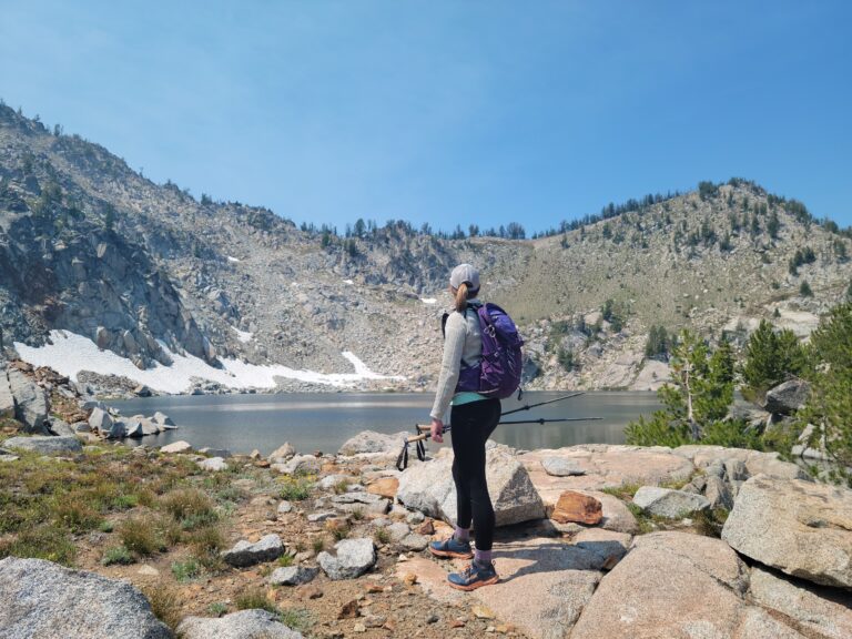
Thirteen Mile Trail
Six miles further south on Route 21 from the Swan Lake turnoff, you will pass Ten Mile Campground (closed) before arriving at the Thirteen Mile trailhead on your left. Let your feet take you as far as you want to go, as the trail is a 16-mile roundtrip hike with views going in both directions. The first mile displays a rich eyeful of tall canyon walls and soothing sounds from the creek below. The trail climbs through an open understory with wildflowers, rocky ledges, meadows and ponderosa pines. Water along the way will dry up as summer progresses, and keep your eyes open for rattlesnakes.
Experience Republic’s Old West Culture
After your hike, head north for a little Old West culture in Republic. The historic gold mining town also offers a look at history with Eocene fossil digs through the Stonerose Interpretive Center (Stonerosefossil.org). The Old West looking downtown includes unique local shops worth checking out. Refresh yourself at Republic Brewing Company with award winning craft beer in an artistically accessorized historic building. The brewery is alive with individuals as genuine as the hills they came from.
The Pacific Northwest Trail Runs Through It
The Pacific Northwest Scenic Trail (known as the PNT) is a long distance path which starts at Glacier National Park and winds through the northern reaches of Montana, Idaho, and Washington to its end at the Pacific Ocean. Covering the most wild and scenic regions of each state, sections of the PNT cross through the Salmo-Priest Wilderness and the Kettle River Range in northeast Washington. The National Forest Service and the Pacific Northwest Trail Association are partners in developing a plan for the PNT which includes route completion, creating optimal user experiences, and connecting hikers to communities along the way. Learn more about the PNT at www.fs.usda.gov/pnt. Satisfy the desire which has accompanied humanity since the beginning of our time, walking the path of nature.
Navigating Northeast Washington Trails Just Got Easier
I moved to Colville from the State of Maine in the dark and sight unseen. Driving 395 and leaving the Spokane lights behind, night gave way to vast valleys and shadowy contours of a full-bodied landscape with hills and larger peaks further north. In the weeks prior to my journey westward, I was consumed by studying online topo maps, the Colville National Forest Service website and images of 49 Degrees North Mountain Resort. It soon became apparent that good trail maps for the region were hard to come by.
I found that Northeast Washington hides a variety of trails less traveled. Sure, the Kettle River Range is a well-known classic graced by 7,000 foot peaks, yet several of the 21 trails along the range are (seemingly) rarely used. To the east lie the Selkirk Mountains and the Salmo-Priest Wilderness. These wild places provide space to spread your wings away from the crowds of other popular hiking destinations.
Finding trail maps and information for this region is getting easier. A new website containing maps for trails in Ferry, Stevens and Pend Oreille Counties is a unique resource which also provides trail access points, descriptions and brief histories of the region. Local historian and map developer Joe Barreca has created Google interactive trail maps that can be accessed via mobile devices, within satellite range and independent of cell service. This amenity is especially helpful in rural areas where cell phone service is not always an option. The website is live, but is under construction and is scheduled to be completed by July 1. To view and download northeast Washington trail maps and photos, visit NeWashingtonTrails.com. // (Katie LeBlanc)