By Paul Delaney
Cover photo courtesy of Paul Delaney
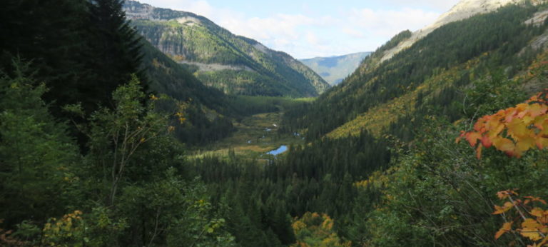
Mother Nature seems to want to protect as best as possible a picturesque canyon south of Spokane that contains Latah Creek. The stream’s banks are largely private property criss-crossed by barbed wire. Access from above is also limited. That leaves the creek itself as the only way to see what’s at the bottom. That, too, comes at the wishes of the weather, most likely in the throes of winter or maybe on the shoulders of spring.
Commonly now called by its original name, Latah Creek, this narrow water southwest of Spokane still officially carries its darker designation, Hangman Creek. Call it what you will, the stream cuts its 60-mile muddy course from Charles Butte in Benewah County, east of DeSmet, Idaho, and empties into the Spokane River west of downtown, often staining the river with a ribbon of brown. In-between, when the conditions are just right, Latah offers experienced rafters and kayakers a truly unique view of a place that only moving water can take them.
Generally that paddling window is from January through March when mid-level (4,000 feet) snowpack is plentiful and a quick melt, abundant rains — or both — drive flows. Latah Creek’s runnable peaks are volatile, often lasting just 24 to 48 hours. The Northwest Whitewater Association website provides a direct link to current flows.
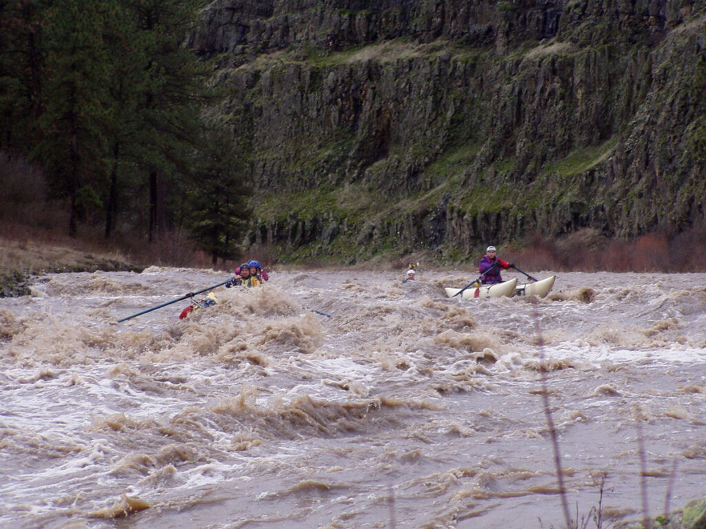
Suffice to say that in the traditional sense, there is not a hint of “whitewater” on Latah Creek. That’s thanks to the stream being surrounded in large part by agriculture. When the thaw comes to make it runnable, so does topsoil and farm chemicals that give Latah its unique aroma. It is always advisable from those who know to try not to let Latah Creek water enter eyes, nose, ears and mouth, because who knows what bugs that can incubate? The run is still well worth the tiny risk of illness as Latah Creek offers spectacular canyon views, sometimes with frozen water runoff clinging high on the basalt cliffs.
As for wild (not white) water, there’s that, too. Just enough for a thrill and challenge navigating on the upper section containing Keevey (Class III-IV depending on water levels) and Cliffside (Class III) rapids. The remainder of the run has the benefit of a steady current to push one along.
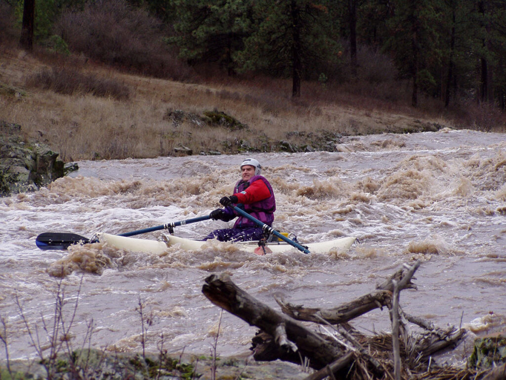
Keevey is just a couple of miles into the run and can be seen upstream from the Keevey Road bridge. Its challenging and tumultuous big waves require careful “read-and-run” skills. Latah’s brown water disguises holes and other obstacles quite well.
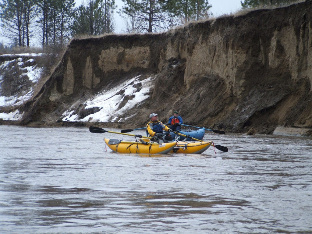
Most boaters who run Latah Creek use either catarafts or kayaks. Rafts could easily suffer floor damage from a creek bed littered with sharp basalt rocks ranging up to boulder size. If the notion has not already been enforced, Latah Creek is, for various reasons, not for novices.
Latah’s water conditions, remoteness and the requirement for the best boating equipment are top considerations. Because of very cold, turbid water, the need for proper clothing—drysuits or at least wetsuits—is imperative. A swim in the generally shallow creek can cause serious injury and is not advised for obvious reasons.
Here are some logistics if one does decide to give it a go. There are two popular Latah Creek segments. The approximately 11-mile Class III-IV canyon section starts at North Kentuck Trails Road between Rockford and Spangle. It can end at Valley Chapel Road bridge or at an easier exit a couple of miles downstream at Elder and Valley Chapel roads. The launch is just yards west of the place where in 1854 Col. George Wright’s soldiers hung several Native Americans, including Chief Qualchan, which is why this creek is also historically known as Hangman Creek. The site is memorialized and provides parking for boaters.
The second segment is about six miles in length, offers Class II+ water, begins near Hatch Road off U.S. Highway 195 and finishes either at the Marne Bridge on Riverside Ave. or Peoples’ Park in Spokane.
According to veteran rafter Larry Johnson who wrote trip descriptions on Latah for the book, “A Guide to the Whitewater Rivers of Washington,” the first consideration is flow. Ideally that’s between 3,000 to 4,000 cubic-feet-per-second on the upper. The meandering lower section can be run from 500 to 1,500 CFS.
Again, the opportunities to journey down Latah Creek are hit and miss. In any given year there may be several or none. Notable in its recent history, Latah hit an astounding 20,000-plus CFS on Jan. 1, 1997 and stayed at high levels for days. And certainly, out of character was June 14, 2022 where flows topped 5,000 CFS for just a few hours due to heavy spring rains. Seeing boats navigate the creek that day would likely have made for a few double-takes and subsequent bad shots at the adjacent Qualchan Golf Course.
Paul Delaney has been rafting regional rivers since 1980.