Cover photo courtesy of Holly Weiler
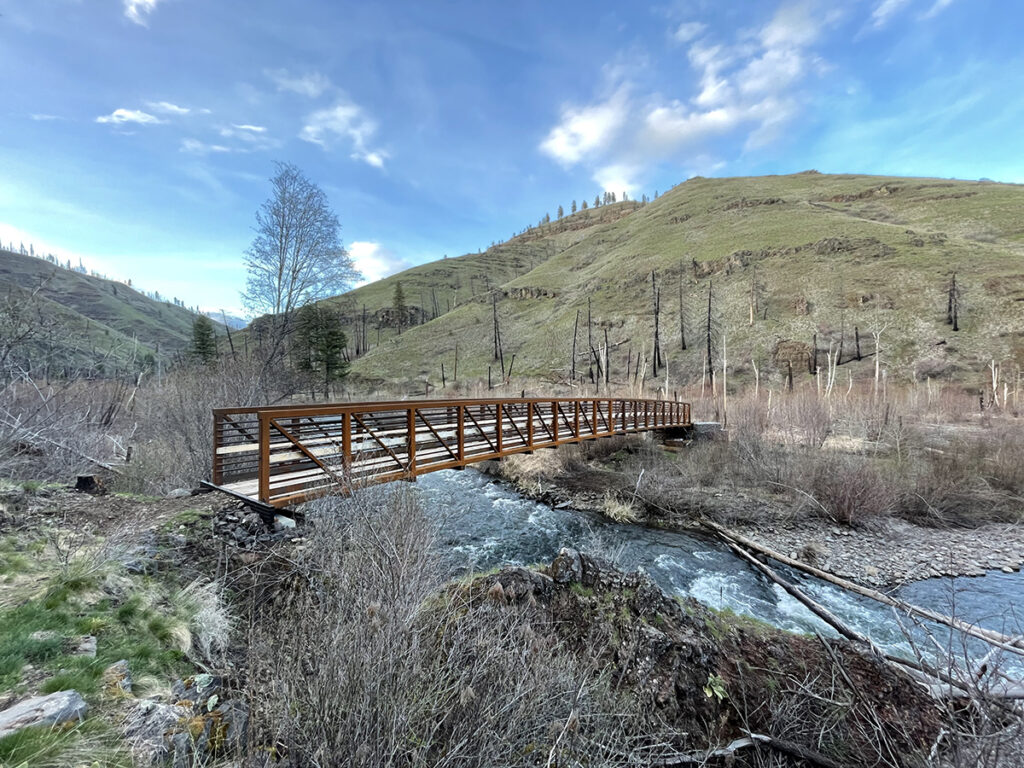
The Wenaha River Trail in northeastern Oregon has long been a popular spring backpacking destination, but, following the loss of the bridge over Crooked Creek during the 2015 Grizzly Complex Fire, access became extremely difficult until spring run-off subsided. This left hikers facing a tricky and potentially dangerous ford or an early turn-around at the 6-mile mark. Fortunately for hikers and backpackers alike, the bridge was rebuilt last fall.
The new bridge is a steel structure with wooden decking and high railings, restoring safe early season access to the remote and rugged Wenaha River canyon. The trail follows the river upstream for 30 miles, so backpackers can choose a turn-around point for trips of various distances. It’s the perfect place for a weekend getaway or a full week of adventure on this designated Wild and Scenic River.
The years without safe bridge access also created a backlog of maintenance needs along the trail, so early visitors to the trail system may find increasingly difficult conditions farther up the river drainage. Already this year, both USFS and volunteer crews have made it as far as the 8-mile mark. Conditions beyond that point are potentially quite brushy. Take it from someone who learned the hard way: wear pants, not shorts, to hike this trail. Crews will be following up with more maintenance, including completing the approaches to each side of the new bridge. It may take several years to complete the full backlog of maintenance needs, and additional trees continue to fall within the burn zone. Plenty of green trees remain, and spring wildflowers put on a fantastic color display. Don’t forget to pack binoculars to spot wildlife in the canyon, where bighorn sheep and elk herds are frequently seen along the trail.
Maps: Wenaha-Tucannon Wilderness map, USFS
Getting There: The Wenaha River Trail is accessed from a small trailhead on the outskirts of Troy, Ore. When entering Troy from the east, turn right at the stop sign and drive a short distance up Bartlett Road. The trailhead is located on the outside edge of the first switchback in the road.
Holly Weiler is the Eastern Washington Region Senior Coordinator for Washington Trails Association and will be alternating morel hunts and trailwork trips this spring.