Clearwater Crossing is one of the best starting locations for a variety of trips into the proposed Great Burn Wilderness. Located just over the Montana border, several of the trails connect to one another and can be combined to form loop trips of varying distances. For one of the less-frequently traveled routes, try the Mud Lake Loop, where hikers can enjoy both deep forest canopy and open mountain ridges—plus dip toes into an alpine lake at 6,216 feet—before returning to the starting point on a connecting trail.
Don’t bother putting on boots at the trailhead, as the hike starts with a crossing of Fish Creek. Unfortunately, the old wooden swinging bridge that used to test hikers’ bravery while keeping their feet dry didn’t survive a 2015 wildfire. By August the waters have generally receded enough to make the crossing manageable, but water-crossing sandals along with trekking poles for extra balance will come in handy for this hike.
The first three miles gently ascend Fish Creek via trail 101. At the first trail junction with trail 110, bear right and continue on 101. At the second junction with trail 104 on the left, note the return trail to complete the loop, and continue up 101, which begins to climb in earnest. Continue past connecting trail 510 on the right, but at trail 121 turn left to ascend the Middle Fork Indian Creek Trail. Ignore all trail mileage markers along the way or face certain disappointment, as the trail has been rerouted at some point in the recent past, and the mileage signs all reflect an earlier era. Try to count the one blessing that the old trails must have been far more steep to have such mileage numbers attached to them.

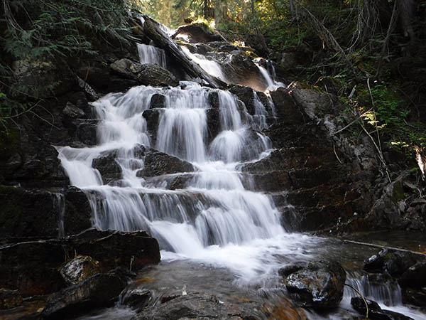
At approximately 8 miles the trail crosses the west fork of Indian Creek at an unnamed waterfall that is a worthy destination by itself. From the waterfall it’s approximately 3 miles to Mud Lake, located on the Montana side of border but so close to the Idaho/Montana Stateline Trail that it’s a worthwhile side hike to touch the Idaho border. Note the upper part of trail 104 intersecting on the left upon the final approach to the lake, as this is the return trail.
Mud Lake has several nice campsites with views of the lake and the crest of the Bitterroots serving as the backdrop. After a night or two of camping, retrace the first section of the route to the trail intersection noted on the approach to the lake, and descend via trail 104. Be sure to fill up water bottles first, as this trail is dry until it reconnects with trail 101. Whereas the hike in is deeply forested and follows a creek, the hike out follows an open ridge for most of the descent. This is an outstanding place to watch for wildlife and also offers fantastic views of the surrounding mountains. It includes a little more climbing, followed by a steep descent where hikers will be happier with trekking poles to help save knees.
At the bottom of the descent, the trail requires two last major stream crossings, first at the point where the trail intersects 101, and finally upon the return to Clearwater Crossing. Clearwater Crossing serves as a free, first-come, first-served rustic campground in addition to a trailhead, which makes it a nice place to camp at the beginning or end of a backpack trip, or a good location to try shorter versions of the trails as part of a car-camping weekend instead of a backpack trip.
Round-trip Distance: Approximately 25 miles
Rating: Difficult
Map: Lolo National Forest Map
Getting There:
Travel I-90 eastbound into Montana and take Fish Creek Exit #66. Follow Fish Creek Road #343 south of I-90 to West Fork Fish Creek Road #7750. Proceed on 7750 to its end at Clearwater Crossing trailhead and campground.
Give back to your trails: Join the Washington Trails Association for a Back Country Response Team work party and backpacking trip in the Colville National Forest August 9-12. //
Holly Weiler is a hiker, backpacker, trail runner, and skier. She writes the Hike of the Month column for Out There.
[Feature photo: View of Bitterroot Mountains from Mud Lake. // Holly Weiler]


