Spokane County, Wash.
Construction of California Creek, the main singletrack trail at Mica Peak Conservation Area, just wrapped up at the end of July 2020 in spite of new complications placed on volunteer projects due to COVID-19. This project has been years in the making, and while the trail has been open and accessible to the public for most of the last year, the much-needed finishing touches are now finally in place—including a completed trailhead and new trail signage. This newest trail in Spokane County is a prime destination for fall exploration.
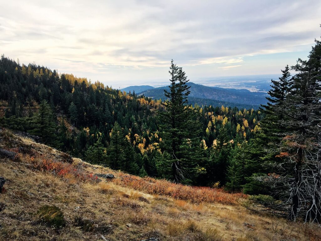
Spokane County Parks acquired the initial 910 acres of Conservation Futures land in 2013, with an additional 884 acres added in 2018. The public property starts at 2,800 feet elevation and ascends to 5,100 feet (the summit at 5,200 feet is not part of the Conservation Area property). Since the parking lot sits at 2,725 feet and reaches the conservation area via a trail easement, all routes to Mica Peak include serious elevation gain. It also makes the area fantastic for year-round exploration with a well-maintained road to the trailhead. Fall is a prime season for a visit to take in the seasonal color transitions, but the area is also fun to explore via skis or snowshoes in winter and has fantastic wildflowers from spring into summer.

The parking lot sits at the end of Belmont Road and just outside the conservation area. Visitors have two choices for a route up from behind the initial gate, both via old logging roads: the route on the left is a conservation easement leading to the county property in 1 mile, whereas the route on the right enters the conservation area via an adjacent Department of Natural Resources (DNR) property. The latter route is recommended since it quickly leads to a singletrack trail and has better views, but visitors can also consider entering one way and exiting via the other option.
When the DNR trail connects onto Mica Peak Conservation Area, continue up a short hill to the main access road through the property. Continue hiking up the roadbed, passing the powerlines, until reaching the first trail sign for California Creek to the left. The first half mile is a narrow connector road to the main California Creek Trail, which is signed and heads immediately uphill on the right. The views improve with every turn as the California Creek trail winds its way up the south face of Mica. The big, climbing turns allow for sweeping views eastward to Idaho’s Mica Peak, westward into Spokane, and southwest to the Palouse.
Originally entitled “Mica Peak Conservation Area” in the Hike of hte Month column in the September-October 2020 double issue.
Trip Details
- Round-trip distance: 8.6 miles
- Rating: Difficult
- Elevation gain: 1,934 feet
- Getting there: Take Washington State Route 27 south from Spokane Valley. Turn east on Belmont Road at the town of Mica. Continue on Belmont Road for 4.5 miles to where it dead ends at the parking lot for Mica Peak Conservation Area.
Support Local Trails
Watch for upcoming opportunities to volunteer on local trails by checking the wta.org volunteer page and sorting to “Eastern Washington” under the region tab. Group size limits are dependent upon current COVID-19 guidelines.
Holly Weiler loves exploring the trails of the Inland Northwest and helping to build new trails as the Eastern Washington Regional Coordinator for Washington Trails Association.


