By David Stpehens
A DAY OF CLIMBING AT CASTLE ROCK DOES NOT HAVE TO BE ALL ABOUT CLIMBING—ESPECIALLY WHEN THAT DAY OF CLIMBING IS SPENT RIGHT NEXT TO THE NORTH FORK OF THE COEUR D’ALENE RIVER AND THE COOL WATER HAS BEEN CALLING YOUR NAME FOR HOURS.
MOST TRIPS TO Castle are topped off with some kind of lazy day side trips. You could keep following the Old River Road upriver for a few more miles as it crosses back over the river and meets up with the Coeur d’Alene River Road again. Taking a left, one could keep driving upriver and reach the little town of Prichard in a few short miles. Then following road NFD 208 farther upriver, the pavement goes on for 30 + miles passing 3 great campgrounds along the way.
This is the start of incredible backcountry, with trail access to hidden waterfalls, weekend adventures, or even just a worthy drive. Take a right at Prichard Creek/NFD 9 and the historic town of Murray, Idaho, home of the Sprag Pole Museum, is up the road another 15 miles or so. One of the many trailheads for the bicycle-lover’s dream Trail of the Coeur d’Alenes is located in Enaville. (Although it’s worth noting that riding this trail could be a whole new day’s adventure.) Without a doubt one of the favorite options after climbing is just taking a simple kayak ride down the river or a dip in one of the many swimming holes. After that a stop at the legendary Snake Pit and a huckleberry milkshake!
GENERAL DIRECTIONS
Go east on I-90 past Coeur d’Alene and take exit 43 and head north to the Beehive cutoff on NFD 209 at about the 5 mile marker, take a left over the river, then a right on Old River Rd NFD 503. The Main Face is about 8 miles or the 11.5 mile mark; it’s hard to miss the crag on your left. Latitude, Longitude: 47.65540, -116.12500
ACKNOWLEDGEMENTS
Without the efforts of climbers’ like Wayne Bagly, Todd Hamm, Grady Roberts, Sara Barron, Rich Woodard, George & Shannon Hughbanks, Russ Shultz, Bill Centenari, Scott Lewis, Dora Rollins and Dane Burns, Castle Rock would still be a forgotten chosspile. Cheers!
The first I heard of Castle Rock/Steamboat was some time in the mid-80s. I was living, climbing, and working in southern California, so reading the news seemed odd… I was a long ways away from the north fork of the Coeur d’Alene River.
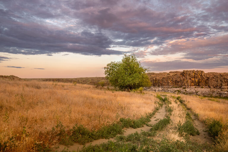
In the summer of 2004 there was more talk about a Steamboat Rock again. This news perked up what was the start of a very hot July. Still charged with some of that old amazement and driven anew by living a lot closer now, I was surprised that without much effort I located a very large formation that matched the description of the area I was looking for but that was called Castle Rock. The area is comprised of satellite crags nestled high above and to the right of a main face. With its base just a few feet off the road and the river itself, this amazing face stands 300 feet high.
The rock is 1.4-billion-year-old Precambrian, composed of weakly metamorphosed sediment. It was originally formed in the shallow waters of a sea that would have covered northern Idaho and extended into parts of Canada and Montana (http://www.idahogeology.org/PDF/GeoNotes_(G)/geonote_40.pdf). This sedimentary rock does not lend itself very well to traditional climbing, although it has seen some very bold trad routes completed. The amount of loose choss in what could be called the cracks here would have sent me home crying like a baby 20 years ago.
Climbing above the anchors, off any of the routes, is not advised. The rock can be well suited for bolted sport climbing, which for the most part is on crimpers, jugs, and side pulls of all kinds up vertical stone. Thanks to much thoughtful attention and exertion by route setters, most pitches are on clean rock. With some routes well over 100 ft long and needing 15 or more bolts, sometimes just clipping the next bolt with 100 ft of rope out can be a test of its own.
All the crags face south/southeast, so they receive a mixed blessing of sun until mid/late-afternoon, when of course all the climbs are then in the shade. The climbs are broken up into 5 areas: THE MAIN FACE, THE TURRET, LEDGE OF DISDAIN, THE ARÊTE, and SHORT AND SHADY. All of these areas but the Main Face are accessed from the same trail at mile mark 12, the small pullout, and the upper trail. Areas are described below as you meet them hiking in on the upper trail; the climbs are then listed from left to right as you face the rock.
The trail to the start of AGAINST THE GRAIN is on the right side of the power pole. The trail hugs the wall up a series of ramps and steps that gain the large grass-covered ledge at the base of the climbs. The rock pit on the left side of the power pole is private land, and so is the beach on the river in front of that, so please help respect the owner’s rights by staying off these areas.
The MAIN FACE of Castle Rock stands alone; it only stops long enough so its summit can create a small bench for the upper routes. There are 3 routes on the left side of this formation; STEAMBOAT ARÊTE is 3 pitches of trad climbing that follows an unknown line to the summit. The route is broken by a large grass-covered ledge; above the left side of this ledge is an open face. Two more trad routes also follow unknown lines up this face. AGAINST THE GRAIN is a 165 ft 5.9. The first pitch is 5.8 and it takes 18 draws to climb its seemingly endless face that comes to a stop 105 ft up on the grass-covered ledge and chains. The second pitch is 60 ft with 8 draws; it starts out right off the chains on a delicate set of moves that help you gain the face above, and ends in an alcove at 2 lower-off anchors. DESCENT: from top anchors lower off 60ft back to the chains, 35 m rappel from the chains to the ground, with a 70 m. rope.
The following areas are all accessed from the upper trail, which can be hard to follow. About 1/2 a mile down the road from the parking for the MAIN FACE, there is a small pullout on the left side of the road. The upper trail starts on the left side of the small stream. The trail picks its way up the steep hillside, then traverses up and over to a ramp that splits the first band of rocks. Following a set of cairns will lead around to the left and up to the rest of the crag and trail.
Before traversing up and over to the ramp, go down a little and then over to the base of SHORT AND SHADY and the ARÊTE crags.
These 2 crags sport the shortest pitches that are to be found. SHORT AND SHADY is a 5.10a that takes the short and shady line on the left side. A LITTLE LESS is a 5.11a that heads up the little less short and shady route on the right. Standing 100 ft to the left is THE ARÊTE crag, which offers 2 very fun routes that grace its sides: DANE DIRTY, a 5.10a, and MORNING ARÊTE, a 5.11a.
After following the set of cairns that lead around to the left, the trail continues on following the contours and the ledges of the cliffs as it wraps its way around up to the base of THE TURRET.
THE TURRET stands over 250 ft above the talus at its base. To approach, climb the narrow chute that leads to the base of a small column. TWENTY-ONE OR BUST is a 5.10c that requires 21 draws and a 70 m rope. It stems up the left side of this column and involves steep face climbing to a difficult crux just before reaching a set of midpoint anchors on the ledge. Once you clip the open hanger you’ll enjoy 50 more feet of climbing before reaching the anchors, making this pitch 21 clips and well over 150 ft long. DESCENT: At the top anchors, lower back to the 50 ft midpoint with a full 35 m rappel back to the ground. FOR THE FALLEN is a 5.10b that takes 18 draws and a 70 m rope. It’s on the right side of the column, with a start on one side of the arête and a finish on the other. DESCENT: At the top anchors, lower back to the 60 ft midpoint and rappel back to the ground. THE BIG DIHEDRAL is a trad route that should strike a little fear in any aspiring hard man.
Continue following the trail as it contours its way around and over to THE LEDGE OF DISDAIN.
This crag sits almost atop the MAIN FACE and offers good climbing, great views, and some of the first shade of the day. THE LEDGE OF DISDAIN seven routes hang in this area, so there’s a little something for everybody. BURNS LIKE A RASH is a 5.10b/c climb with a series of blind moves over the bulges and overhangs. SHANNON, a 5.7, is a very fun romp up low-angle rock. MUNDANE is an 80 ft 5.11b that takes 15 draws. This route climbs one of the most beautiful and compact faces of the whole area. DISDANE is a 5.9 climb that faces just to the right of the corner. It’s a fun route that just does not want to clean up. KEYBOARD CLIMBER is a 5.10b that might be a little stiff for Internet climbers. RAGING HIVE is a steep 5.11b requiring a lot of skills, one of which is the ability to kill wasps on lead! STUNG AND RUN is a 5.? that goes though the blocky overhangs. Clipping the chains might be a FA.