The Selkirk Mountains of North Idaho might be the state’s wildest corner. Until recently, this was the last place you could see wild caribou in the lower 48. The caribou are gone now, but you can still find solitude and expansive vistas on one of the many rocky ridgelines stretching across the range. The shimmering emerald waters of Long Mountain Lake, tucked beneath its namesake peak, are a good introduction to the area. The trailhead is barely 10 miles from the Canadian border, and chances are good you’ll have the lakeshore all to yourself.
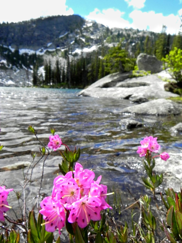
From the trailhead, travel switchbacks up the slope, passing through alpine meadows that open to views of the surrounding peaks. Just over a mile from the trailhead you’ll pass the intersection for Pyramid Lake, a popular day-trip destination. Set beneath a wall of solid granite, Pyramid Lake is a worthy detour. It’s only a half of a mile from the intersection, so you might as well take a look. Boulders on the lakeshore make great lunch spots, and magenta wildflowers carpet the ground near the lake’s outlet.
Returning to the main trail, continue up the switchbacks to Pyramid Pass, ignoring the signed trail to Trout Lake. You’re in the Selkirk high country now, which isn’t actually that high since the tallest peaks barely crest 7,000 feet. But the stark, granitic landscape gives the feel of much larger mountains. Soil is at a premium here, and whitebark pine and subalpine fir carve out a precarious existence between cliffs and boulders. The ecology of the place makes it feel like you’re much higher. Be thankful for easy access to this alpine wonderland, so close to the trailhead!
Continue following the trail over Pyramid Pass. At the intersection with the Long Canyon Trail, stay right. Three miles from the trailhead (not counting the side trip to Pyramid Lake), you’ll top out on Parker Ridge. Snow can linger here late into the summer, so use caution when crossing steep patches. In a heavy snow year, it’s a good idea to bring a traction aide (like MICROspikes or Yaktrax) until mid-July.
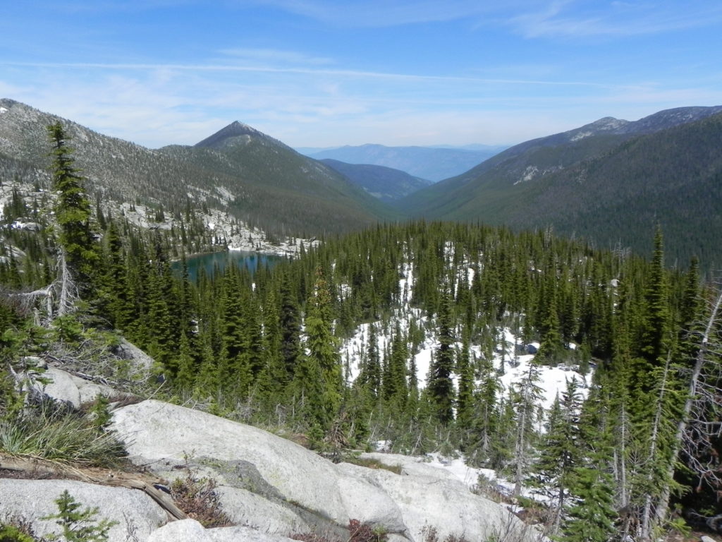
From the crest of Parker Ridge, you’ll have a 360-degree panorama of the surrounding landscape. 7,653-foot Smith Peak dominates the skyline to the west, while the craggy face of 7,288-foot Lions Head is a bit further away to the southwest. Pika can often be found here, scampering among the boulders and chirping loudly to sound the alarm of an approaching hiker.
At mile 4, you’ll reach the turnoff for Long Mountain Lake. Descend switchbacks for half a mile down to the granite-rimmed lake and pick one of the many rocky campsites shaded by gnarled whitebark pine along the lakeshore. In recent years, the subalpine fir and whitebark pine surrounding Long Mountain Lake have been damaged by eager campers seeking firewood. In this fragile alpine environment, where trees grow slowly, it’s better to skip the evening campfire.
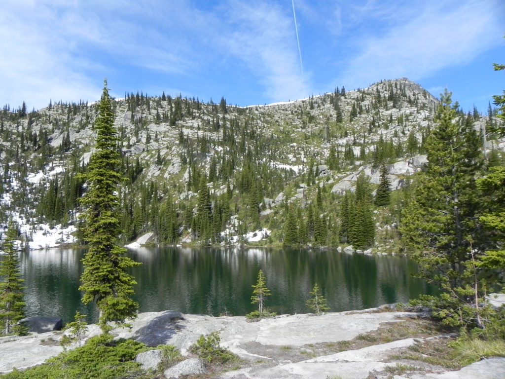
The glistening waters of Long Mountain Lake are a worthy destination in their own right. But 7,670-foot Parker Peak, the tallest named peak in the American Selkirks, is only 5 trail miles away. Consider making a visit if you have a day to kill. The view from the top extends through the rugged heart of the Selkirks all the way to the border town of Creston, British Columbia.
When you’ve had your fill, return the way you came. There are a lot of options for further exploration in this area, including trails to Ball Lakes, Trout Lake, and Long Canyon Creek, so you might find yourself returning sooner than you think!
Location:Selkirk Mountains
Round-trip distance: 10 miles
Rating:Moderate to difficult
Getting there: From Spokane, drive to Bonners Ferry. Continue north on US-95 for 14.8 miles. Turn left on ID-1 for 2.1 miles. Turn left on Copeland Hill road and drive 3.5 miles to the t-intersection with West Side road. Turn left and drive 4.5 miles. Turn right on Trout Creek road and drive 9 miles to the trailhead. Trout Creek road is rough and heavily washboarded, but accessible to 2WD passenger cars. Parking is on the left (south) side of the road, while the trail begins on the right (north) side. P