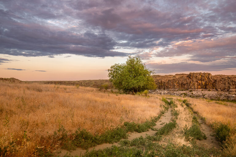
Summer has its charms (alpine lakes, ice cold beverages, and wildflower blooms to name a few), but the cooler temperatures of fall and the anticipation of the leaves changing color has many of us longing to spend our weekends hiking. Here are a few favorite hikes from a couple “Out There Outdoors” contributors for you to explore this fall! // (Siobhan Ebel)
Gold Hill Trail #3 (Ammi Midstokke)
Location: Near Sandpoint in Bonner County, Idaho. The trail is accessed by taking Bottle Bay Rd from Highway 95 approximately 5 miles until the trailhead appears on the right. There is ample parking and a restroom.
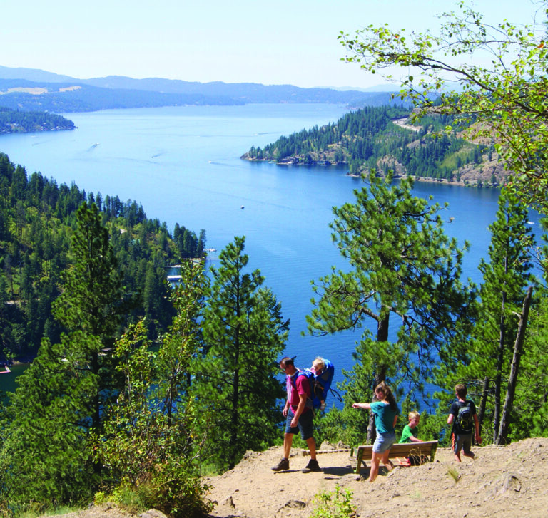
Hike Description: This trail, found just outside of Sandpoint, has a nostalgic attraction for a local, along with all the autumnal wonder any nature lover could hope for. The 2.5 miles to the ‘lookout’ begins with a sustained climb that winds its way through nearly fifty switchbacks. Forested and well-shaded, the crisp autumn mornings here offer hues of gold and red from trailhead to summit. The forest has both coniferous and deciduous trees, and later autumn hikes promise a carpet of bright leaves. Most people stop at the obvious viewpoint, but hikers can continue for nearly another mile for more vistas of the bright colors that surround Lake Pend Oreille. From the initial view point, one has an expansive view of Sandpoint, the western end of Lake Pend Oreille, the Pend Oreille River, and the Selkirk Mountains. Years ago, my dad set a family record running this trail (33 minutes up, 22 minutes down), and it is my life goal to someday crush his time. Every fall he asks me, “Did you beat my time yet?” And every fall, I wish I had tried harder. For us average spirits, the hike takes 2-3 hours round trip.
Round-trip Distance: 5-7 miles depending on how far you feel like going.
Level of Difficulty: Moderate. It is a good climb, gaining something near 1,500 feet. The singletrack trail is well worn, wide, and easy to navigate.
Upper Holland Lake Loop (Aaron Theisen)
Location: North of Missoula, Montana, in the Swan Range.
Hike Description: The larch-fronted shores of popular Holland Lake in the Seeley-Swan valley north of Missoula are the departure point for a classic 12-mile backpacking loop high into the Swan Crest. The six-mile hike to Upper Holland Lake parallels the crooks and cascades of Holland Creek; backward glances reveal Holland Lake below and the snow-clad panorama of the Mission Mountains to the west. Upper Holland Lake is a miniature version of its low-elevation kin, a wooded pool with a moose-friendly marsh at the inlet. But the star is Sapphire Lake, which is actually a pair of tarns perched on stacked bedrock benches a mile or so of climbing beyond Upper Holland Lake. The lakes mirror the layer-cake pyramid of Little Carmine Peak directly across the Holland Creek drainage; to the east unfurl the endless bastions of the Bob Marshall Wilderness. A popular horse packing portal into the Bob Marshall Wilderness, the Upper Holland Lake loop can get crowded on summer weekends. Autumn, when the crowds have thinned and the western larch put on their golden show, is the time to go. Be aware that snow stacks up in the Swans beginning in early autumn; bring waterproof boots and plan for minor route-finding challenges on the leeward side of the Crest.
Round-trip Distance: 12.1 miles
Level of Difficulty: Difficult
Mount Spokane Summit and Alpine Ski Area Tour (Amy S. McCaffree)
Location: Mount Spokane State Park
Hike Description: While not a specific trail, this hiking route leads you to the best summit vantage points within the alpine ski area, starting from the Vista House. Bring warm layers—it’s cool and often windy here in the fall. From the top of Chair 1, hike southwest past the cell and radio towers to a designated viewing area that includes picnic tables and viewing markers that identify distant lakes. Return to the “top of 1” (skier jargon for Chair 1) and follow the Gold Cross trail, leading to the top of Chair 2. Consult the huge wooden ski park map sign if you’re unfamiliar with the ski park runs. To your left off Gold Cross you’ll see the new runs on the “backside of the mountain” and where a new chairlift is currently being installed. Eventually, you come to a small ski patrol building (left) and Chair 2 (right)—stay left and hike down Northwest Passage. All around the open ski runs you’ll see foliage turning amber and red hues, including huckleberry bushes; some may still have berries. Hike down the Skookum run; at the bottom, head left across the bowl and up to the top of Chair 3 to enjoy more stellar views. Depending on how far you want to hike, turn around at any point or follow Half Hitch, from top of 3, down to the cat track—a dirt service road that traverses down to the lower chairlifts and Lodge 2. Be aware of vehicles using the road for summer maintenance operations. (All alpine public services are closed until opening day of ski season.)
Note: This fall, there will be periodic closures of the Summit Road for chairlift installation, especially when a helicopter is needed. Call either the ski area (509-238-2220) or state park ranger office (509-238-4258) to inquire about closures, especially on weekdays.
Round-trip Distance: Up to approximately 3 miles round-trip, but varies based on your turn-around point.
Level of Difficulty: Easy to Moderate. //
[Feature photo: Mt. Spokane // Shallan Knowles]